Terminal Island
Geographic communities
(318)
California
(1247)
Terminal Island
(249)
Related articles from the
Densho Encyclopedia :
Terminal Island, California
249 items
249 items
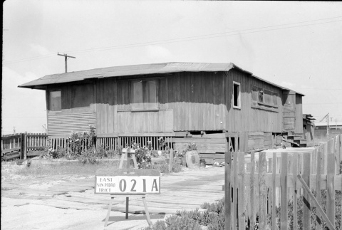
img
Building labeled East San Pedro Tract 021A (ddr-csujad-43-155)
Photograph number 1501 of a building on Terminal Island. Sign reads: East San Pedro Tract 021A. Negative scan. See this object in the California State Universities Japanese American Digitization project site: ter_02_051
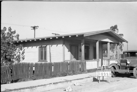
img
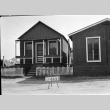
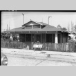
House labeled East San Pedro Tract 099A (ddr-csujad-43-62)
Photograph number 1202 of a house on Terminal Island that has a car parked in front. The sign in front of the car reads: East San Pedro Tract 099A. Negative scan. See this object in the California State Universities Japanese American Digitization project site: ter_01_083
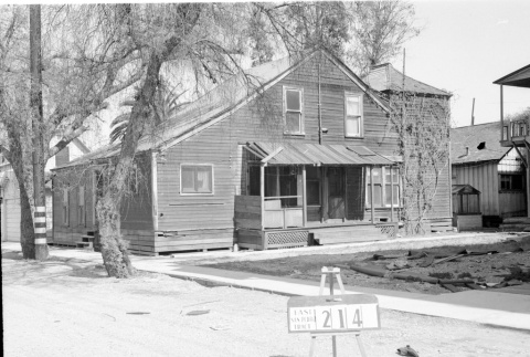
img
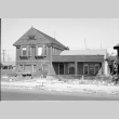
Building labeled East San Pedro Tract 214 (ddr-csujad-43-125)
Photograph number 1389 of a two story building on Terminal Island. Sign reads: East San Pedro Tract 214. Negative scan. See this object in the California State Universities Japanese American Digitization project site: ter_02_019
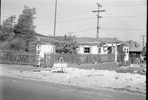
img
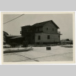
Multiple houses labeled East San Pedro Tract 107A (ddr-csujad-43-71)
Photograph number 1214 of multiple homes on Terminal Island. The house in the middle is numbered 609. Sign reads: East San Pedro Tract 107A. Negative scan. See this object in the California State Universities Japanese American Digitization project site: ter_01_095
img
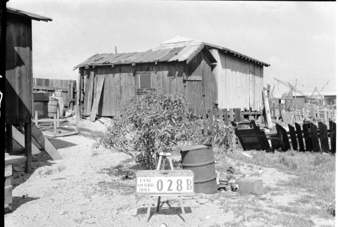
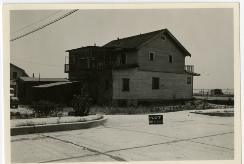
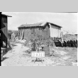
Building labeled East San Pedro Tract 028B (ddr-csujad-43-172)
Photograph number 1520 of possibly the back of a house on Terminal Island. Cranes and shipping containers can be seen in the background. Sign reads: East San Pedro Tract 028B. Negative scan. See this object in the California State Universities Japanese American Digitization project site: ter_02_070
img
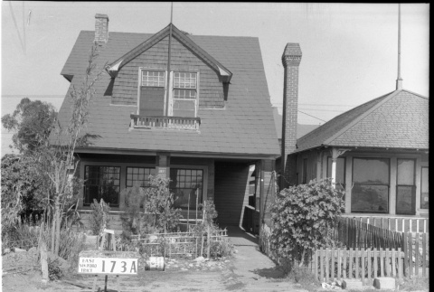
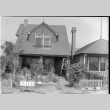
House labeled East San Pedro Tract 173A (ddr-csujad-43-37)
Photograph number 1176 of a two story house numbered 317 on Terminal Island. Sign reads: East San Pedro Tract 173A. Negative scan. See this object in the California State Universities Japanese American Digitization project site: ter_01_058
img
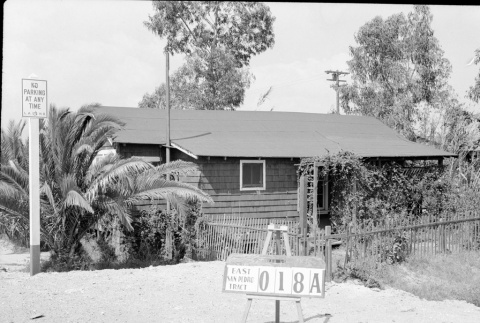
House labeled East San Pedro Tract 018A (ddr-csujad-43-158)
Photograph number 1504 of a house next to a no parking sign on Terminal Island. Sign reads: East San Pedro Tract 018A. Negative scan. See this object in the California State Universities Japanese American Digitization project site: ter_02_054
img
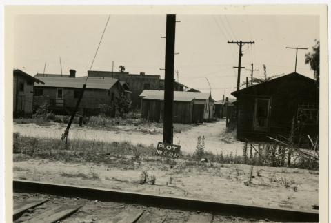
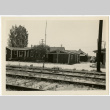
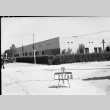
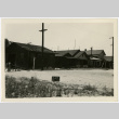
Street view of Terminal Island (ddr-csujad-43-242)
Photograph of railroad tracks near Terminal Island. The sign near the tracks reads: Plot no. [number] 6 29 42. See this object in the California State Universities Japanese American Digitization project site: ter_04_034
img
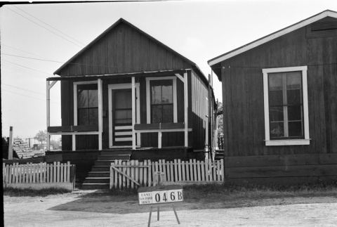
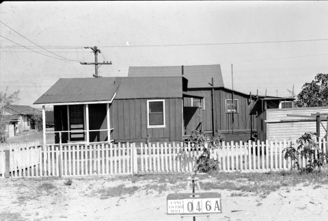
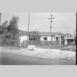
House labeled East San Pedro Tract 046B (ddr-csujad-43-126)
Photograph number 1390 of a house on Terminal Island. Sign reads: East San Pedro Tract 046B. Negative scan. See this object in the California State Universities Japanese American Digitization project site: ter_02_020
img
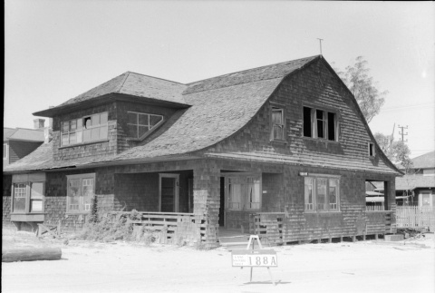
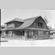
House labeled East San Pedro Tract 188A (ddr-csujad-43-66)
Photograph number 1206 of the side of a two story house on Terminal Island. Sign reads: East San Pedro Tract 188A. Negative scan. See this object in the California State Universities Japanese American Digitization project site: ter_01_087
img
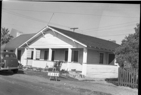
House labeled East San Pedro Tract 108A (ddr-csujad-43-74)
Photograph number 1217 of a house numbered 108 on Terminal Island. The sign behind the parked car reads: East San Pedro Tract 108A. Negative scan. See this object in the California State Universities Japanese American Digitization project site: ter_01_098
img
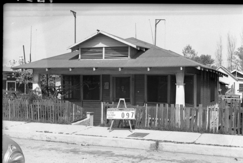
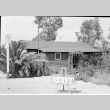
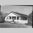
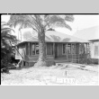
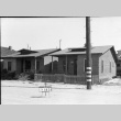
House labeled East San Pedro Tract 097 (ddr-csujad-43-90)
Photograph number 1234 of a house on Terminal Island. Other homes are pictured behind it. The Sign in front of the fence reads: East San Pedro Tract 097. Negative scan. See this object in the California State Universities Japanese American Digitization project site: ter_01_116
img
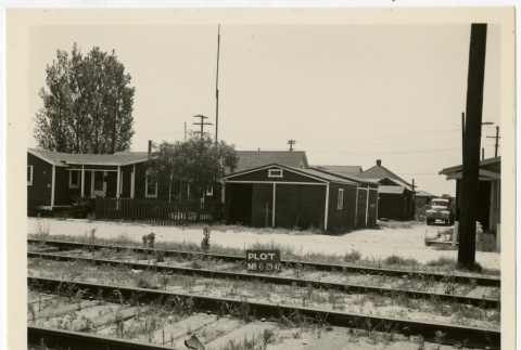
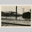
Street view of Terminal Island (ddr-csujad-43-238)
Photograph of rows of houses on Terminal Island. A railroad track is also pictured. The sign in front of the pole reads: Plot no. [number] 6 29 42. See this object in the California State Universities Japanese American Digitization project site: ter_04_029
img
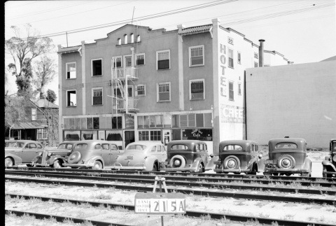
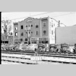
Lone Rooms and Apartments and Busy Bee Cafe (ddr-csujad-43-175)
Photograph number 1523 of the [Lone] Rooms and Apartments (hotel) and Busy Bee Cafe on Terminal Island. Cars pictured parked across the street. The sign on the train tracks reads: East San Pedro Tract 215A. Negative scan. See this object in the California State Universities Japanese American Digitization project site: ter_02_073
img
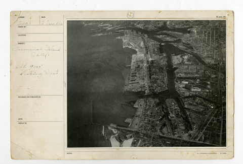
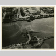
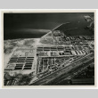
Terminal Island looking west (ddr-csujad-43-264)
Aerial photograph number 2008 of Terminal Island. Caption reads: Terminal Island, Calif. [California] Alt. [Altitude] 9000' looking west. See this object in the California State Universities Japanese American Digitization project site: ter_05_002
img
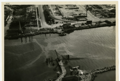
Aerial view of naval drydocks (ddr-csujad-43-258)
Aerial photograph number 5838 of Terminal Island, San Pedro and Long Beach. Note on the back side reads: Naval Drydocks, Terminal Island, San Pedro, California. Long Beach Entrance Channel, Retractable Pontoon Bridge, looking east toward Long Beach. Contract Noy-8012. Aerial. See this object in the California State Universities Japanese American Digitization project site: ter_04_063_001
img
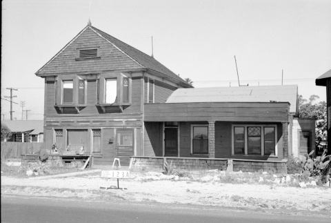
House labeled East San Pedro Tract 123A (ddr-csujad-43-68)
Photograph number 1208 of a house numbered 321 on Terminal Island. Sign reads: East San Pedro Tract 123A. Negative scan. See this object in the California State Universities Japanese American Digitization project site: ter_01_089
img
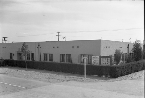
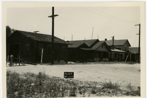
Airport Market (ddr-csujad-43-227)
Photograph of the backside of Airport Market on Terminal Island. The sign in the street reads: Plot No. [number] 6 29 42. See this object in the California State Universities Japanese American Digitization project site: ter_04_018
img
Japanese Baptist Church (ddr-csujad-43-14)
Photograph number 949 of Japanese Baptist Church on the corner of Ways Street and Terminal Way on Terminal Island. Handwritten note on negative sleeve reads: Habitation near N.A.S. [Naval Air Station] and N.O.B. [Naval Operation Base] Roosevelt Base T.I. (Terminal Island). Negative scan. See this object in the California State Universities Japanese American Digitization project site: …
img
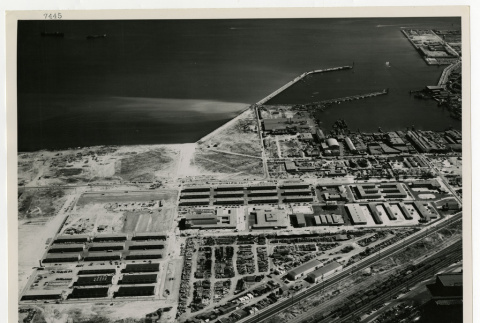
Naval Operating Base (ddr-csujad-43-259)
Aerial photograph number 7445 of Terminal Island. Note on the back side reads: Naval Operating Base, Terminal Island (San Pedro), California. Receiving station, looking south southeast. Contract Noy-8008. Title from note. See this object in the California State Universities Japanese American Digitization project site: ter_04_064_001
img
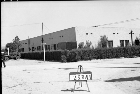
Japanese Baptist Church (ddr-csujad-43-136)
Photograph number 1479 of the Japanese Baptist Church on the corner of Terminal Way and Ways Street on Terminal Island. A military truck can be seen next to church. Sign reads: 252A1. Negative scan. See this object in the California State Universities Japanese American Digitization project site: ter_02_030
img
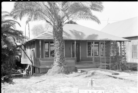
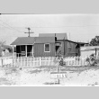
House labeled East San Pedro Tract 046A (ddr-csujad-43-171)
Photograph number 1519 of the side of a house on Terminal Island. Sign reads: East San Pedro Tract 046A. Negative scan. See this object in the California State Universities Japanese American Digitization project site: ter_02_069
img
House labeled East San Pedro Tract 196A (ddr-csujad-43-123)
Photograph 1387 of a house numbered 217 on Terminal Island. Sign reads: East San Pedro Tract 196A. Negative scan. See this object in the California State Universities Japanese American Digitization project site: ter_02_017
img
Houses on corner of Riverside Place (ddr-csujad-43-215)
Photograph of a row of houses on the corner of Riverside Place on Terminal Island. Sign reads: Plot no. [number] 6 29 42. See this object in the California State Universities Japanese American Digitization project site: ter_04_003
img
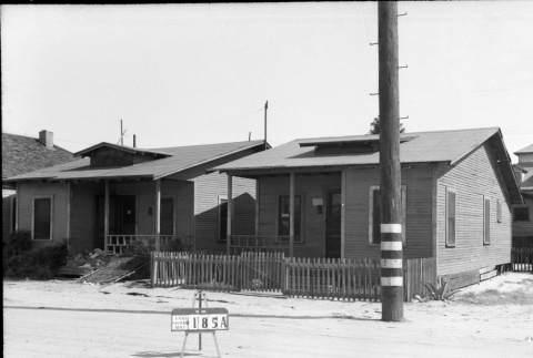
Houses labeled East San Pedro Tract 185A (ddr-csujad-43-109)
Photograph number 1293 of two houses on Terminal Island. The sign in the middle of the street reads: East San Pedro Tract 185A. Negative scan. See this object in the California State Universities Japanese American Digitization project site: ter_01_140