Terminal Island
Geographic communities
(318)
California
(1247)
Terminal Island
(249)
Related articles from the
Densho Encyclopedia :
Terminal Island, California
249 items

249 items
img
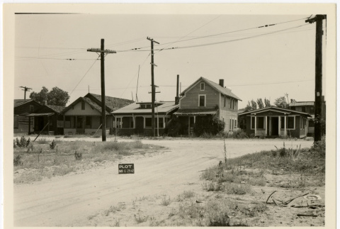
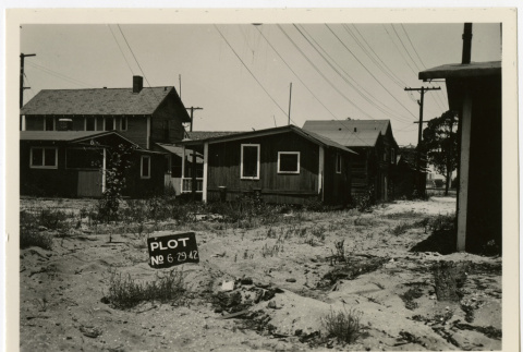
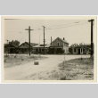
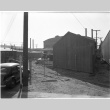
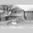
Street view of Terminal Island (ddr-csujad-43-235)
Street view of houses on Terminal Island. The sign in the middle of the street reads: Plot no. [number] 6 29 42. See this object in the California State Universities Japanese American Digitization project site: ter_04_026
img
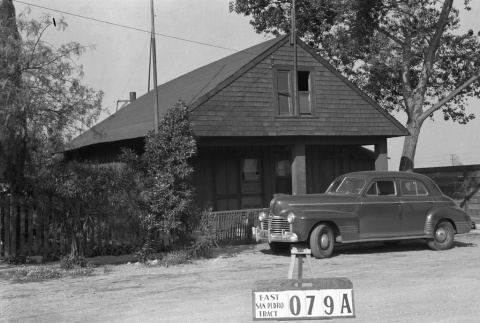
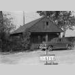
House labeled East San Pedro Tract 079A (ddr-csujad-43-163)
Photograph number 1509 of a house on Terminal Island that has a car parked in front. Sign reads: East San Pedro Tract 079A. Negative scan. See this object in the California State Universities Japanese American Digitization project site: ter_02_059
img
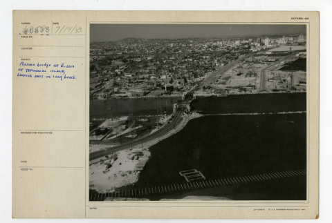
Pontoon bridge near Long Beach (ddr-csujad-43-270)
Aerial photograph number 6858 of the pontoon bridge. Caption reads: Pontoon bridge at E. [east] end of Terminal Island, looking east to Long Beach. See this object in the California State Universities Japanese American Digitization project site: ter_05_009
img
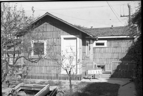
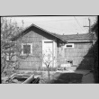
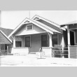
House labeled East San Pedro Tract 119B (ddr-csujad-43-70)
Photograph number 1213 of the house, possibly numbered 5E on Terminal Island. Sign reads: East San Pedro Tract 119B. Negative scan. See this object in the California State Universities Japanese American Digitization project site: ter_01_094
img
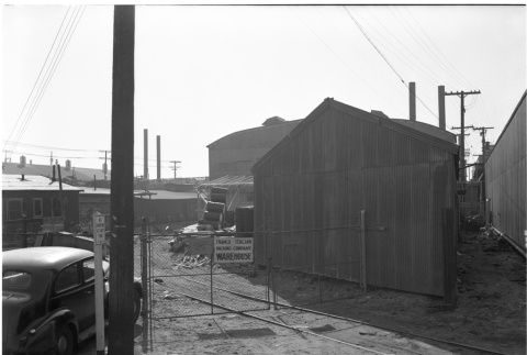
Franco Italian Packing Company Warehouse (ddr-csujad-43-27)
Photograph of Franco Italian Packing Company Warehouse on Terminal Island. Negative scan. See this object in the California State Universities Japanese American Digitization project site: ter_01_046
img
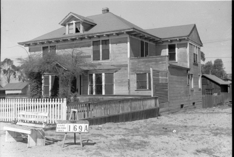
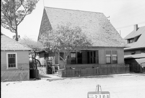
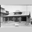
Building labeled East San Pedro Tract 169A (ddr-csujad-43-63)
Photograph number 1203 of a two story building, possibly a house, on Terminal Island. The sign near the bench reads: East San Pedro Tract 169A. Negative scan. See this object in the California State Universities Japanese American Digitization project site: ter_01_084
img
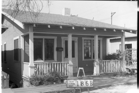
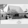
House labeled East San Pedro Tract 186B (ddr-csujad-43-31)
Photograph number 1170 of a house numbered 107 on Terminal Island. Sign reads: East San Pedro Tract 186B. Negative scan. See this object in the California State Universities Japanese American Digitization project site: ter_01_052
img
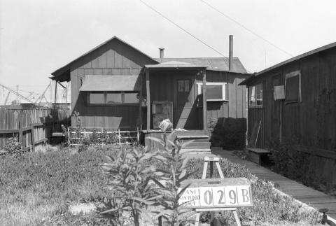
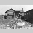
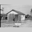
House labeled East San Pedro Tract 029B (ddr-csujad-43-165)
Photograph number 1512 of a house on Terminal Island. Sign reads: East San Pedro Tract 029B. Negative scan. See this object in the California State Universities Japanese American Digitization project site: ter_02_062
img
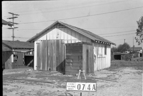
Building labeled East San Pedro Tract 074A (ddr-csujad-43-118)
Photograph number 1380 of the back of a building on Terminal Island. Sign reads: East San Pedro Tract 074A. Negative scan. See this object in the California State Universities Japanese American Digitization project site: ter_02_010
img
House labeled East San Pedro Tract 118A (ddr-csujad-43-73)
Photograph number 1216 of a house on Terminal Island. Three or more cars are pictured in the front of and on the side of the house. Sign reads: East San Pedro Tract 118A. Negative scan. See this object in the California State Universities Japanese American Digitization project site: ter_01_097
img
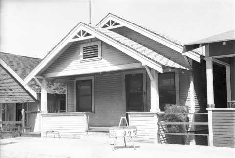
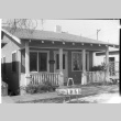
House labeled East San Pedro Tract 095 (ddr-csujad-43-84)
Photograph number 1228 of three houses, the one in the middle numbered 112 on Terminal Island. The sign in front of the middle house reads: East San Pedro Tract 095. Negative scan. See this object in the California State Universities Japanese American Digitization project site: ter_01_110
img
House labeled East San Pedro Tract 115A (ddr-csujad-43-58)
Photograph number 1198 of a house numbered 104 on Terminal Island. Sign reads: East San Pedro Tract 115A. Negative scan. See this object in the California State Universities Japanese American Digitization project site: ter_01_079
img
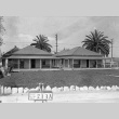
Houses on Terminal Island (ddr-csujad-43-184)
Photograph number 2163 of houses on Terminal Island. Negative scan. See this object in the California State Universities Japanese American Digitization project site: ter_02_082
img
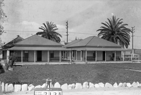
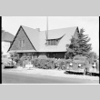
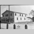
Glenburnie Rooms labeled East San Pedro Tract 213A (ddr-csujad-43-102)
Photograph number 1286 of Glenburnie Rooms on Terminal Island. The sign in front of the rocks reads: East San Pedro Tract 213A. Negative scan. See this object in the California State Universities Japanese American Digitization project site: ter_01_133
img
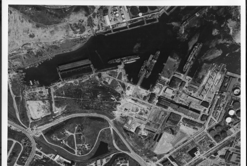
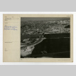
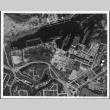
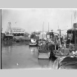
Fish Harbor (ddr-csujad-43-5)
Aerial photograph number 341 of Fish Harbor, Terminal Island at an altitude of 6,000 feet. Negative scan. See this object in the California State Universities Japanese American Digitization project site: ter_01_005
img
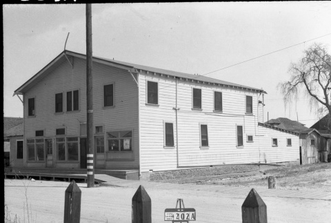
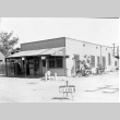
Building labeled East San Pedro Tract 202A (ddr-csujad-43-97)
Photograph number 1280 of a two story building, possibly a business or store front on Terminal Island. Sign reads: East San Pedro Tract 202A. Negative scan. See this object in the California State Universities Japanese American Digitization project site: ter_01_127
img
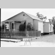
House labeled East San Pedro Tract 210A (ddr-csujad-43-151)
Photograph number 1497 of a house on Terminal Island that has a fence. Sign reads: East San Pedro Tract 210A. Negative scan. See this object in the California State Universities Japanese American Digitization project site: ter_02_047
img
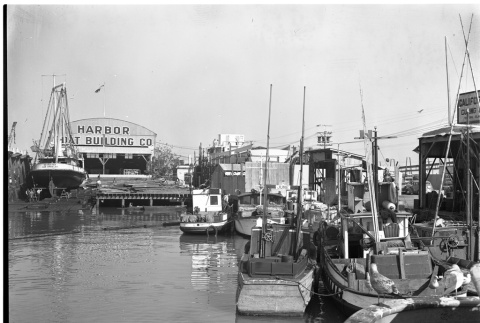
Harbor Boat Building Company (ddr-csujad-43-22)
Photograph number 1095 of Harbor Boat Building Company. California Marine Curling and Packing Company can be seen off to the right side. Negative scan. See this object in the California State Universities Japanese American Digitization project site: ter_01_039

img
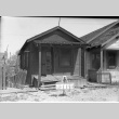
House on Terminal Island (ddr-csujad-43-187)
Photograph number 2201 of a house on the corner of Ocean Avenue on Terminal Island. Negative scan. See this object in the California State Universities Japanese American Digitization project site: ter_02_085
img
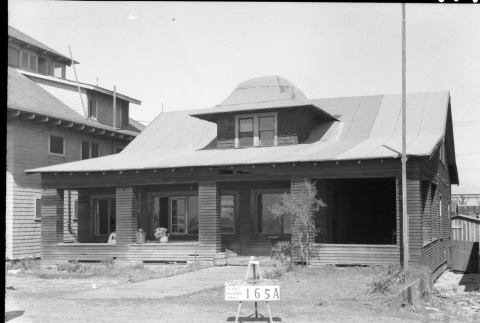
House labeled East San Pedro Tract 165A (ddr-csujad-43-50)
Photograph number 1190 of a house on Terminal Island. Sign reads: East San Pedro Tract 165A. Negative scan. See this object in the California State Universities Japanese American Digitization project site: ter_01_071
img
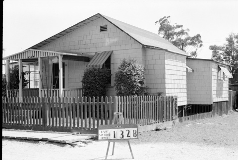
House labeled East San Pedro Tract 132B (ddr-csujad-43-170)
Photograph number 1518 of a house numbered 526 on Terminal Island. Sign reads: East San Pedro Tract 132B. Negative scan. See this object in the California State Universities Japanese American Digitization project site: ter_02_068
img
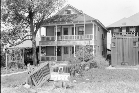
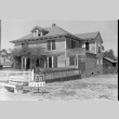
House labeled East San Pedro Tract 192A (ddr-csujad-43-148)
Photograph number 1493 of a two story house or residence on Terminal Island. The sign near the fence reads: East San Pedro Tract 192A. Negative scan. See this object in the California State Universities Japanese American Digitization project site: ter_02_044
img
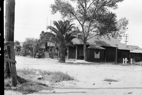
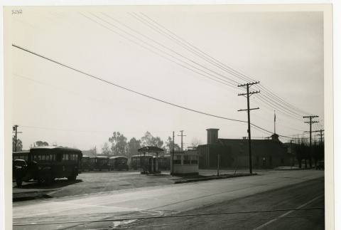
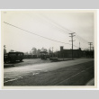
Seaside Avenue looking south southeast (ddr-csujad-43-256)
Photograph number SP-5992 of Seaside Avenue on Terminal Island. Note on the back side of photograph reads: Looking south southeast from the south side of Seaside Avenue. Five hundred feet easterly from Tuna Street, showing existing fire station in right hand background. Terminal Island, Calif. [California]. See this object in the California State Universities Japanese American …
img
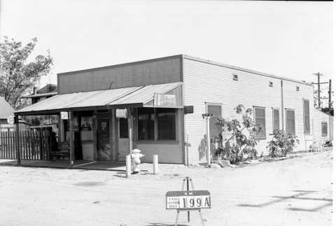
Cafe on the corner of Ocean Avenue (ddr-csujad-43-169)
Photograph number 1517 of a cafe on the corner of Ocean Avenue and Bayone Place. Sign reads: East San Pedro Tract 199A. Negative scan. See this object in the California State Universities Japanese American Digitization project site: ter_02_067
img
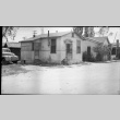
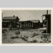
Back of houses on Terminal Island (ddr-csujad-43-231)
Photograph of the back of houses on Terminal Island. Sign reads: Plot no. [number] 6 29 42. See this object in the California State Universities Japanese American Digitization project site: ter_04_022