Aftermath
The "evacuation" of Japanese Americans from their homes on the West Coast reduced once-thriving communities to ghost towns. Having only a week to prepare for the removal, many Japanese Americans were forced to board up and abandon businesses and homes. Rampant anti-Japanese sentiment in newspapers, theater newsreels, and radio broadcasts fueled acts of vandalism against the vacated neighborhoods.
World War II
(283)
Mass removal ("evacuation")
(746)
Aftermath
(307)
Related articles from the
Densho Encyclopedia :
Culbert Olson
307 items
307 items
img
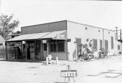
Cafe on the corner of Ocean Avenue (ddr-csujad-43-169)
Photograph number 1517 of a cafe on the corner of Ocean Avenue and Bayone Place. Sign reads: East San Pedro Tract 199A. Negative scan. See this object in the California State Universities Japanese American Digitization project site: ter_02_067
img
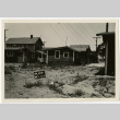
Back of houses on Terminal Island (ddr-csujad-43-231)
Photograph of the back of houses on Terminal Island. Sign reads: Plot no. [number] 6 29 42. See this object in the California State Universities Japanese American Digitization project site: ter_04_022
img
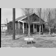
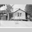
Building labeled 283A1 (ddr-csujad-43-139)
Photograph number 1484 of a building, possibly a storefront on Terminal Island. Sign reads: 283A1. Negative scan. See this object in the California State Universities Japanese American Digitization project site: ter_02_035
img
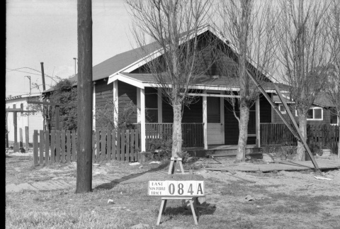
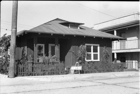
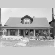
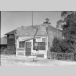
House labeled East San Pedro Tract 084A (ddr-csujad-43-114)
Photograph number 1376 of a house on Terminal Island. Sign reads: East San Pedro Tract 084A. Negative scan. See this object in the California State Universities Japanese American Digitization project site: ter_02_006
img
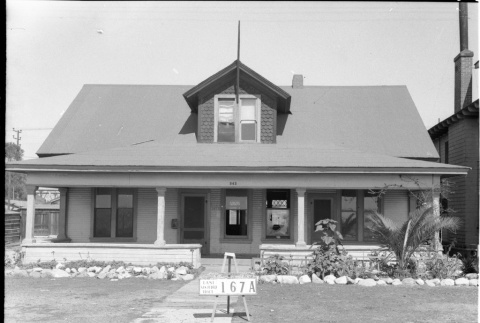
House labeled East San Pedro Tract 167A (ddr-csujad-43-46)
Photograph number 1186 of a house numbered 343 on Terminal Island. Sign reads: East San Pedro Tract 167A. Negative scan. See this object in the California State Universities Japanese American Digitization project site: ter_01_067
img
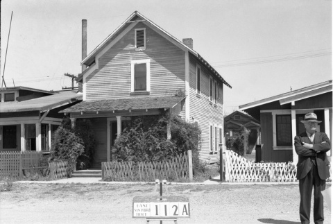
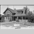
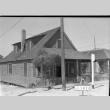
House labeled East San Pedro tract 112A (ddr-csujad-43-116)
Photograph number 1378 of a two story house on Terminal Island. A man is pictured standing in front of the house next door. Sign reads: East San Pedro Tract 112A. Negative scan. See this object in the California State Universities Japanese American Digitization project site: ter_02_008
img
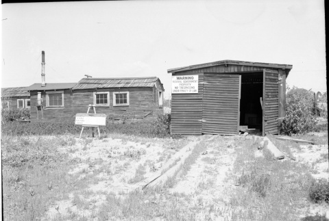
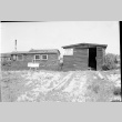
Building labeled East San Pedro Tract (ddr-csujad-43-156)
Photograph number 1502 of a building, possibly a garage, on Terminal Island. A federal government warning sign is attached. The sign to the left of the building reads: East San Pedro Tract. Negative scan. See this object in the California State Universities Japanese American Digitization project site: ter_02_052
img
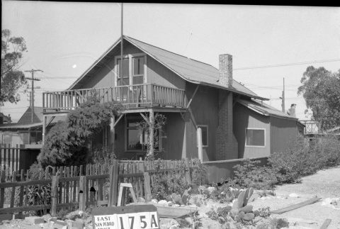
House labeled East San Pedro Tract 175A (ddr-csujad-43-48)
Photograph number 1188 of a two story house on Terminal Island. Sign reads: East San Pedro Tract 175A. Negative scan. See this object in the California State Universities Japanese American Digitization project site: ter_01_069

img
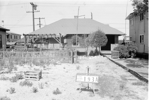
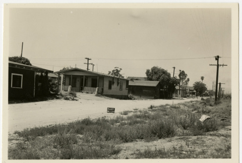
House labeled East San Pedro Tract 193A (ddr-csujad-43-147)
Photograph number 1492 of a house on Terminal Island. Sign reads: East San Pedro Tract 193A. Negative scan. See this object in the California State Universities Japanese American Digitization project site: ter_02_043
img
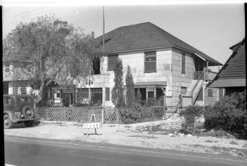
House labeled East San Pedro Tract 119A (ddr-csujad-43-77)
Photograph number 1220 of a two story house on Terminal Island. The sign behind the parked car reads: East San Pedro Tract 119A. Negative scan. See this object in the California State Universities Japanese American Digitization project site: ter_01_101
img
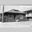
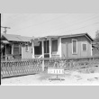
House labeled East San Pedro Tract 104A (ddr-csujad-43-33)
Photograph number 1172 of a house on Terminal Island with a fence. Sign reads: East San Pedro Tract 104A. Negative scan. See this object in the California State Universities Japanese American Digitization project site: ter_01_054
img
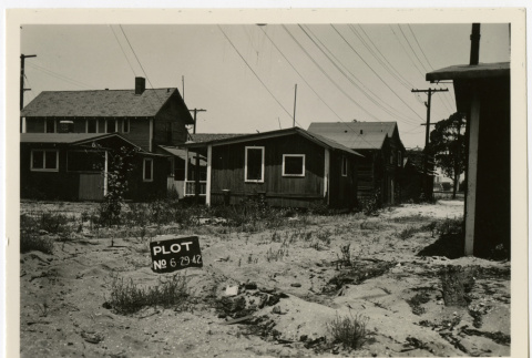
House on the corner of Genda Place (ddr-csujad-43-230)
Photograph on a house on the corner of [Genda Place] and Ocean Avenue on Terminal Island. The sign in front of the palm tree reads: Plot no. [number] 6 29 42. See this object in the California State Universities Japanese American Digitization project site: ter_04_021
img
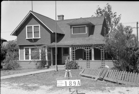
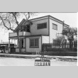
House labeled East San Pedro Tract 189A (ddr-csujad-43-115)
Photograph number 1377 of a two story house numbered 253 on Terminal Island. Sign reads: East San Pedro Tract 189A. Negative scan. See this object in the California State Universities Japanese American Digitization project site: ter_02_007
img
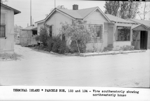
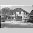
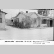
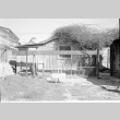
Terminal Island-Parcels nos.133 and 134 (ddr-csujad-43-181)
Photograph number [2160] of houses on Terminal Island. Caption reads: Terminal Island - Parcels Nos. [numbers] 133 and 134 -View southwesterly showing northeasterly house. Negative scan. Title from caption. See this object in the California State Universities Japanese American Digitization project site: ter_02_079
img
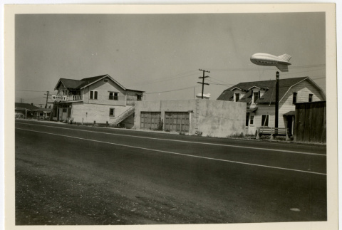
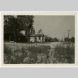
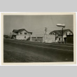
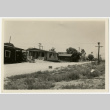
Corner of North Seaside Avenue (ddr-csujad-43-224)
Photograph of North Seaside Avenue on Terminal Island. Airport Market is pictured to the left of the photograph with two barrage balloons floating nearby. The sign near the garage reads: Plot no. [number] 6 29 42. See this object in the California State Universities Japanese American Digitization project site: ter_04_015
img
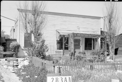
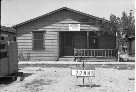
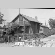
House labeled 279A1 (ddr-csujad-43-131)
Photograph number 1474 of a house on Terminal Island with a federal government warning sign attached. Sign reads: 279A1. Negative scan. See this object in the California State Universities Japanese American Digitization project site: ter_02_025
img
Scranton Walk (ddr-csujad-43-244)
Photograph of houses on Ocean Avenue and the corner of Scranton [Walk] on Terminal Island. The sign near the grass reads: Plot no. [number] 6 29 42. See this object in the California State Universities Japanese American Digitization project site: ter_04_037
img
House labeled East San Pedro Tract 119C (ddr-csujad-43-79)
Photograph number 1222 of the back of a house on Terminal Island. Sign reads: East San Pedro Tract 119C. Negative scan. See this object in the California State Universities Japanese American Digitization project site: ter_01_103
img
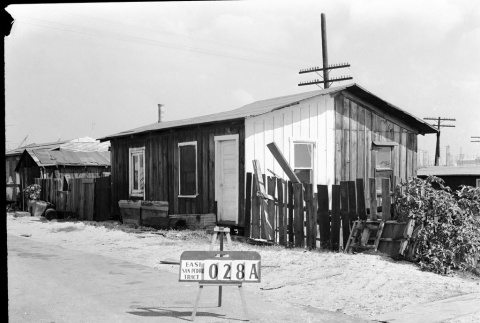
Building labeled East San Pedro tract 028A (ddr-csujad-43-177)
Photograph number 1525 of a building, possibly a house, on Terminal Island. Sign reads: East San Pedro Tract 028A. Negative scan. See this object in the California State Universities Japanese American Digitization project site: ter_02_075
img
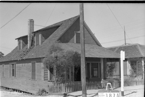
House labeled East San Pedro Tract 187A (ddr-csujad-43-29)
Photograph number 1167 of a house on the corner of Harris Place on Terminal Island. Sign reads: East San Pedro Tract 187A. Negative scan. See this object in the California State Universities Japanese American Digitization project site: ter_01_050
img
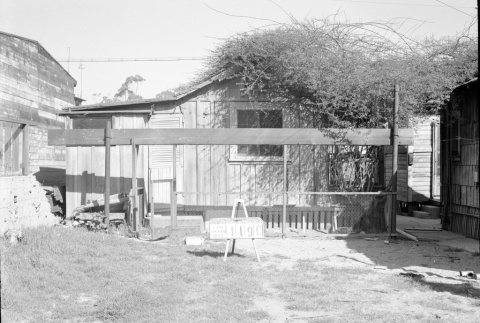
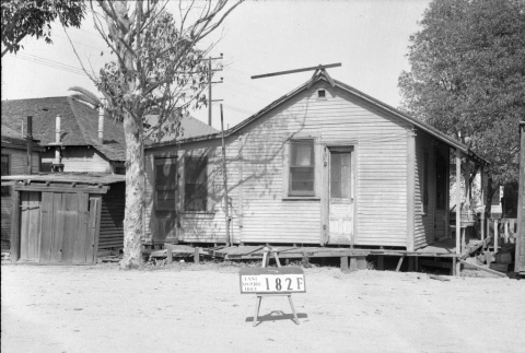
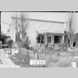
House labeled East San Pedro Tract 182F (ddr-csujad-43-95)
Photograph number 1277 of the side of a house on Terminal Island. Sign reads: East San Pedro Tract 182F. Negative scan. See this object in the California State Universities Japanese American Digitization project site: ter_01_124
img
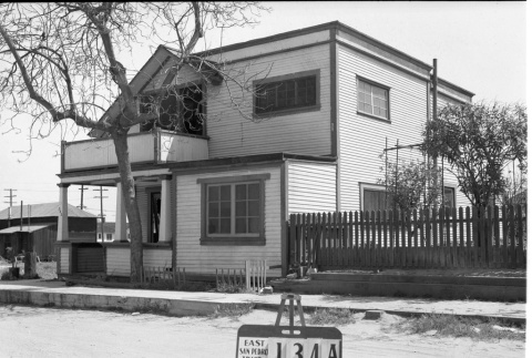
House labeled East San Pedro Tract 134A (ddr-csujad-43-121)
Photograph number 1383 of a two story house numbered 542 on Terminal Island. Sign reads: East San Pedro Tract 134A. Negative scan. See this object in the California State Universities Japanese American Digitization project site: ter_02_013
img
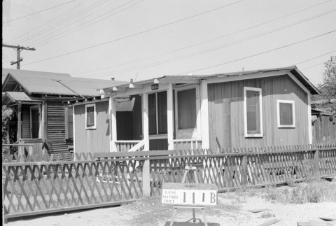
House labeled East San Pedro Tract 111B (ddr-csujad-43-149)
Photograph number 1494 of a house numbered 116 1/2 on Terminal Island. The sign near the fence reads: East San Pedro Tract 111B. Negative scan. See this object in the California State Universities Japanese American Digitization project site: ter_02_045
img
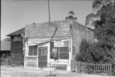
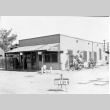
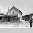
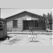
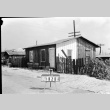
Storefront labeled East San Pedro Tract 143A (ddr-csujad-43-49)
Photograph number 1189 of a storefront on Terminal Island that has a federal government warning sign attached. The sign in front of the store reads: East San Pedro Tract 143A. Negative scan. See this object in the California State Universities Japanese American Digitization project site: ter_01_070
img
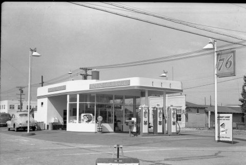
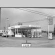
Union Oil Dealer gas station (ddr-csujad-43-130)
Photograph number 1394 of a Union Oil Dealer gas station on Terminal Island. Two cars are parked near the gas station. Sign reads: 244A1. Negative scan. See this object in the California State Universities Japanese American Digitization project site: ter_02_024