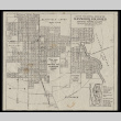
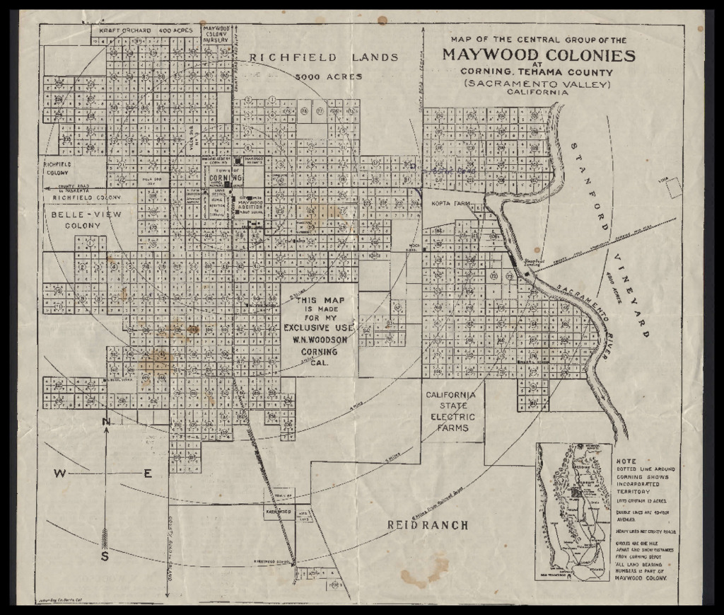
Map of the central group of the Maywood Colonies at Corning, Tehama County; Heart of the Maywoold Colonies Corning, California

PARTNER
CSU Japanese American History Digitization Project
Visit partner
OBJECT ID
ddr-csujad-55-2496 (CSUJAD Local ID: sac_jaac_2602, CSUJAD Project ID: sac_jaac_2602)
PARENT COLLECTION
CSU Sacramento Japanese American Archival Collection
DESCRIPTION
Map and document regarding the Maywood Colonies in Corning, California. Covers population growth and agricultural development in California, Shasta Dam, water rights, farming and employment in Corning, and the olive industry. See this object in the California State Universities Japanese American Digitization project site: sac_jaac_2602
DATE
circa 1945
LOCATION
OBJECT GENRE
Maps
OBJECT FORMAT
Document
FACILITY
CREATORS
- Woodson, W.N. (author)
PERSONS/ORGANIZATIONS
CONTRIBUTOR
California State University, Sacramento, Department of Special Collections and University Archives
PREFERRED CITATION
Courtesy of California State University, Sacramento, Department of Special Collections and University Archives
RIGHTS
Copyright restricted