Florin area, California

PARTNER
CSU Japanese American History Digitization Project
Visit partner
OBJECT ID
ddr-csujad-55-2472 (CSUJAD Local ID: sac_jaac_2578, CSUJAD Project ID: sac_jaac_2578)
PARENT COLLECTION
CSU Sacramento Japanese American Archival Collection
DESCRIPTION
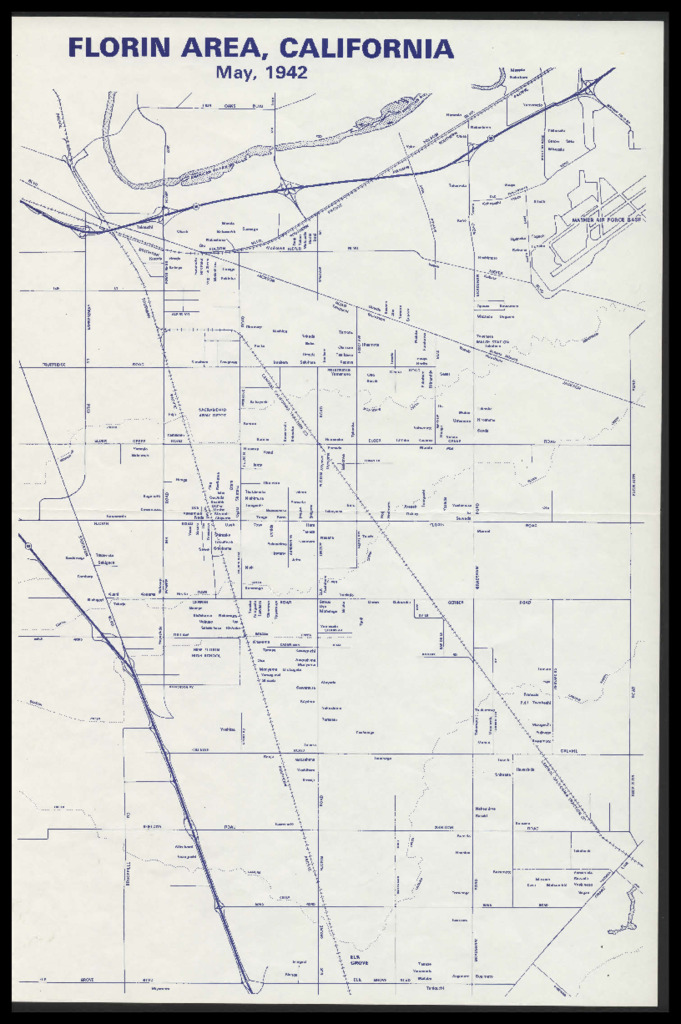
Map of the greater Florin area, near Sacramento, California, from Elk Gove Blvd. to the south and highway 50 to the north. Map depicts land areas owned by Japanese individuals in May 1942. See this object in the California State Universities Japanese American Digitization project site: sac_jaac_2578
DATE
circa 1990
LOCATION
OBJECT GENRE
Miscellaneous Documents
OBJECT FORMAT
Document
FACILITY
CREATORS
PERSONS/ORGANIZATIONS
CONTRIBUTOR
California State University, Sacramento, Department of Special Collections and University Archives
PREFERRED CITATION
Courtesy of California State University, Sacramento, Department of Special Collections and University Archives
RIGHTS
Copyright restricted