Term Objects
DDR objects for specified facet term
`facet_id`: "topics", "facility", "format", "genre", or "rights".
`term_id`: A term ID from one of the following lists:
- http://partner.densho.org/vocab/api/0.2/topics.json
- http://partner.densho.org/vocab/api/0.2/facility.json
- http://partner.densho.org/vocab/api/0.2/format.json
- http://partner.densho.org/vocab/api/0.2/genre.json
- http://partner.densho.org/vocab/api/0.2/rights.json
GET /api/0.2/facet/topics/490/objects/?format=api&limit=25&offset=0
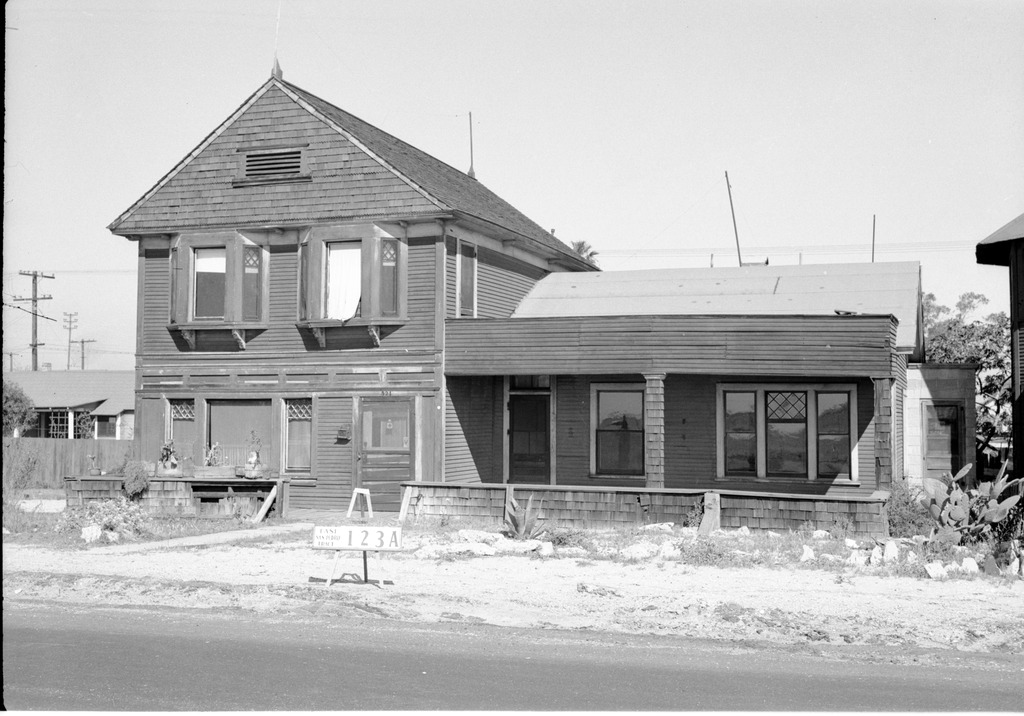
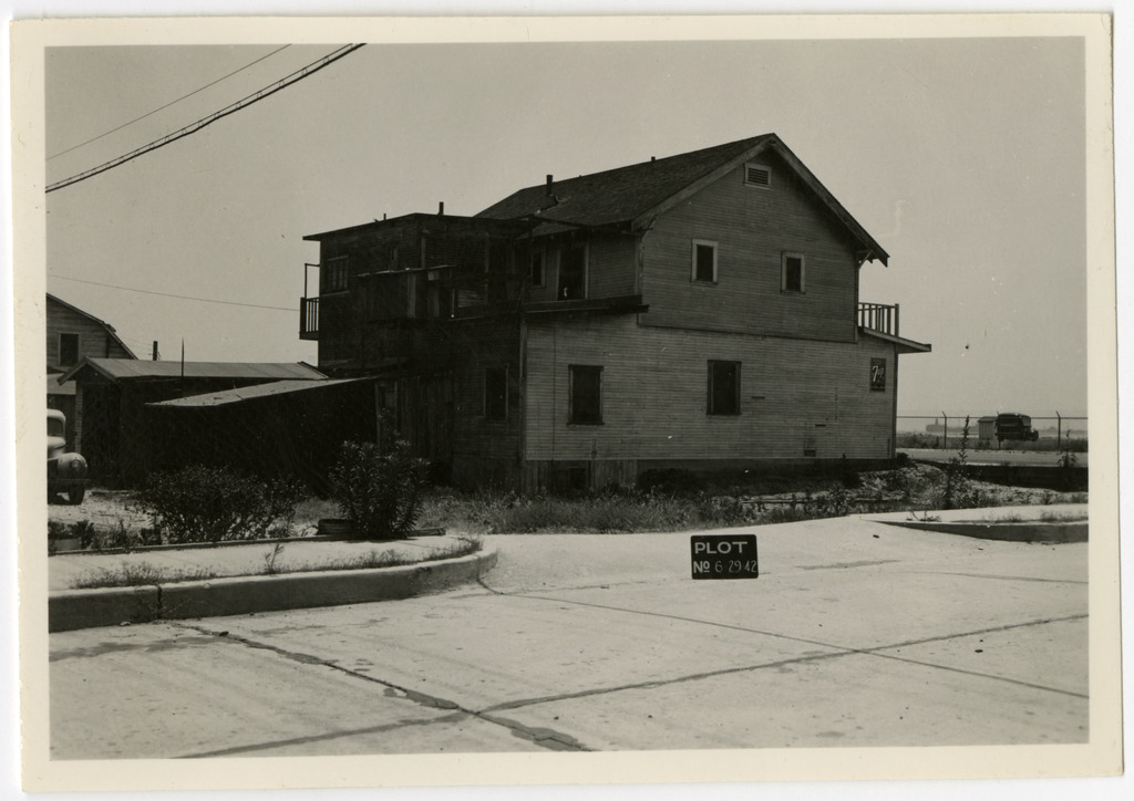
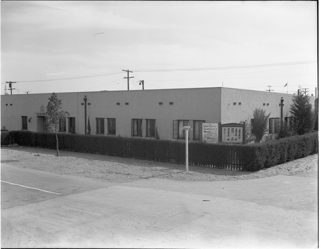
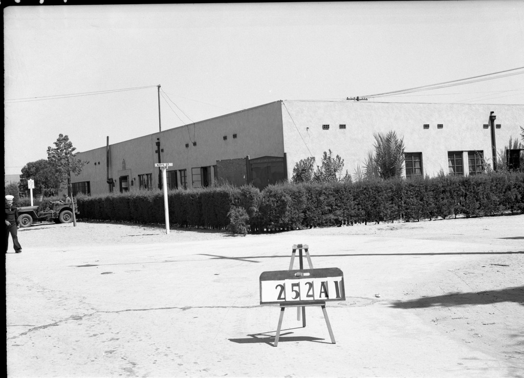
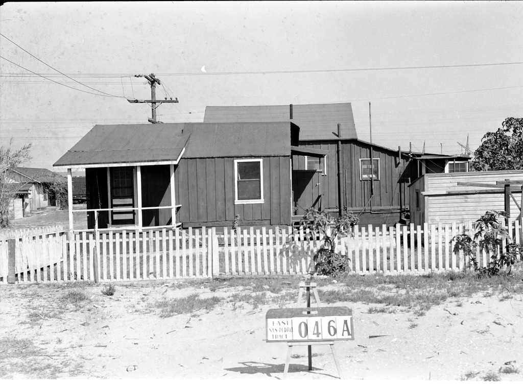
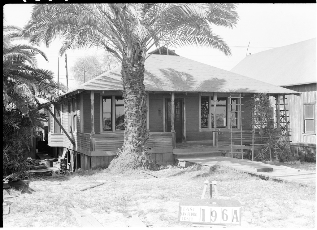
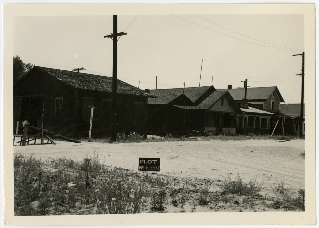
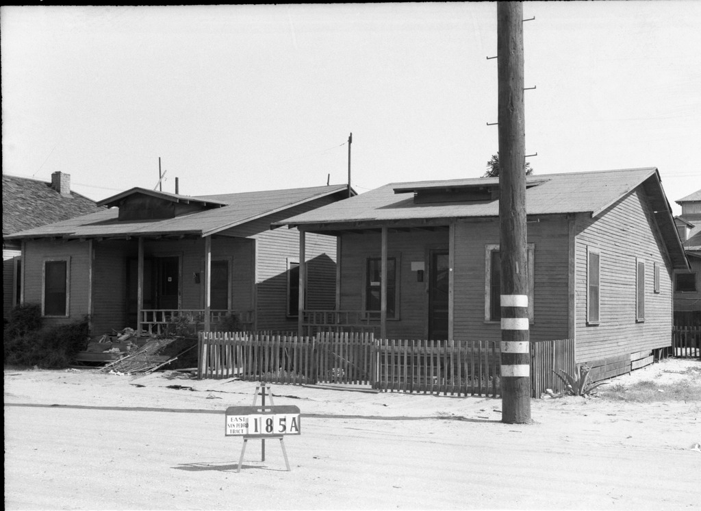
{ "total": 248, "limit": 25, "offset": 0, "prev_offset": null, "next_offset": 25, "page_size": 25, "this_page": 1, "num_this_page": 25, "prev_api": "", "next_api": "https://ddr.densho.org/api/0.2/facet/topics/490/objects/?format=api&limit=25&offset=25", "objects": [ { "id": "ddr-csujad-43-155", "model": "entity", "index": "0 0/{'value': 248, 'relation': 'eq'}", "links": { "html": "https://ddr.densho.org/ddr-csujad-43-155/?format=api", "json": "https://ddr.densho.org/api/0.2/ddr-csujad-43-155/?format=api", "img": "https://ddr.densho.org/media/ddr-csujad-43/ddr-csujad-43-155-mezzanine-daa1bccc1f-a.jpg", "thumb": "http://ddrmedia.local/media/ddr-csujad-43/ddr-csujad-43-155-mezzanine-daa1bccc1f-a.jpg" }, "title": "Building labeled East San Pedro Tract 021A", "description": "Photograph number 1501 of a building on Terminal Island. Sign reads: East San Pedro Tract 021A. Negative scan. See this object in the California State Universities Japanese American Digitization project site: <a href=\"http://cdm16855.contentdm.oclc.org/cdm/ref/collection/p16855coll4/id/37822\" target=\"_blank\" rel=\"noopener noreferrer\">ter_02_051</a>", "extent": "black and white, 2 x 3 inches", "links_children": "ddr-csujad-43-155", "topics": [ { "term": "Geographic communities -- California -- Terminal Island", "id": "490" }, { "term": "World War II -- Mass removal (\"evacuation\") -- Aftermath", "id": "191" } ], "format": "img", "language": [ "eng" ], "contributor": "CSU Dominguez Hills Department of Archives and Special Collections", "rights": "nocc", "genre": "photograph", "location": "Terminal Island, California", "creation": "3/31/1942", "status": "completed", "search_hidden": "", "download_large": "ddr-csujad-43-155-mezzanine-daa1bccc1f-a.jpg" }, { "id": "ddr-csujad-43-62", "model": "entity", "index": "1 1/{'value': 248, 'relation': 'eq'}", "links": { "html": "https://ddr.densho.org/ddr-csujad-43-62/?format=api", "json": "https://ddr.densho.org/api/0.2/ddr-csujad-43-62/?format=api", "img": "https://ddr.densho.org/media/ddr-csujad-43/ddr-csujad-43-62-mezzanine-db545d3de9-a.jpg", "thumb": "http://ddrmedia.local/media/ddr-csujad-43/ddr-csujad-43-62-mezzanine-db545d3de9-a.jpg" }, "title": "House labeled East San Pedro Tract 099A", "description": "Photograph number 1202 of a house on Terminal Island that has a car parked in front. The sign in front of the car reads: East San Pedro Tract 099A. Negative scan. See this object in the California State Universities Japanese American Digitization project site: <a href=\"http://cdm16855.contentdm.oclc.org/cdm/ref/collection/p16855coll4/id/37736\" target=\"_blank\" rel=\"noopener noreferrer\">ter_01_083</a>", "extent": "black and white, 2 x 3 inches", "links_children": "ddr-csujad-43-62", "topics": [ { "term": "Geographic communities -- California -- Terminal Island", "id": "490" }, { "term": "World War II -- Mass removal (\"evacuation\") -- Aftermath", "id": "191" } ], "format": "img", "contributor": "CSU Dominguez Hills Department of Archives and Special Collections", "rights": "nocc", "genre": "photograph", "location": "Terminal Island, California", "creation": "3/21/1942", "status": "completed", "search_hidden": "", "download_large": "ddr-csujad-43-62-mezzanine-db545d3de9-a.jpg" }, { "id": "ddr-csujad-43-125", "model": "entity", "index": "2 2/{'value': 248, 'relation': 'eq'}", "links": { "html": "https://ddr.densho.org/ddr-csujad-43-125/?format=api", "json": "https://ddr.densho.org/api/0.2/ddr-csujad-43-125/?format=api", "img": "https://ddr.densho.org/media/ddr-csujad-43/ddr-csujad-43-125-mezzanine-8c8a733dfa-a.jpg", "thumb": "http://ddrmedia.local/media/ddr-csujad-43/ddr-csujad-43-125-mezzanine-8c8a733dfa-a.jpg" }, "title": "Building labeled East San Pedro Tract 214", "description": "Photograph number 1389 of a two story building on Terminal Island. Sign reads: East San Pedro Tract 214. Negative scan. See this object in the California State Universities Japanese American Digitization project site: <a href=\"http://cdm16855.contentdm.oclc.org/cdm/ref/collection/p16855coll4/id/37877\" target=\"_blank\" rel=\"noopener noreferrer\">ter_02_019</a>", "extent": "black and white, 2 x 3 inches", "links_children": "ddr-csujad-43-125", "topics": [ { "term": "Geographic communities -- California -- Terminal Island", "id": "490" }, { "term": "World War II -- Mass removal (\"evacuation\") -- Aftermath", "id": "191" } ], "format": "img", "language": [ "eng" ], "contributor": "CSU Dominguez Hills Department of Archives and Special Collections", "rights": "nocc", "genre": "photograph", "location": "Terminal Island, California", "creation": "3/27/1942", "status": "completed", "search_hidden": "", "download_large": "ddr-csujad-43-125-mezzanine-8c8a733dfa-a.jpg" }, { "id": "ddr-csujad-43-71", "model": "entity", "index": "3 3/{'value': 248, 'relation': 'eq'}", "links": { "html": "https://ddr.densho.org/ddr-csujad-43-71/?format=api", "json": "https://ddr.densho.org/api/0.2/ddr-csujad-43-71/?format=api", "img": "https://ddr.densho.org/media/ddr-csujad-43/ddr-csujad-43-71-mezzanine-a18c06bddb-a.jpg", "thumb": "http://ddrmedia.local/media/ddr-csujad-43/ddr-csujad-43-71-mezzanine-a18c06bddb-a.jpg" }, "title": "Multiple houses labeled East San Pedro Tract 107A", "description": "Photograph number 1214 of multiple homes on Terminal Island. The house in the middle is numbered 609. Sign reads: East San Pedro Tract 107A. Negative scan. See this object in the California State Universities Japanese American Digitization project site: <a href=\"http://cdm16855.contentdm.oclc.org/cdm/ref/collection/p16855coll4/id/37743\" target=\"_blank\" rel=\"noopener noreferrer\">ter_01_095</a>", "extent": "black and white, 2 x 3 inches", "links_children": "ddr-csujad-43-71", "topics": [ { "term": "Geographic communities -- California -- Terminal Island", "id": "490" }, { "term": "World War II -- Mass removal (\"evacuation\") -- Aftermath", "id": "191" } ], "format": "img", "contributor": "CSU Dominguez Hills Department of Archives and Special Collections", "rights": "nocc", "genre": "photograph", "location": "Terminal Island, California", "creation": "3/21/1942", "status": "completed", "search_hidden": "", "download_large": "ddr-csujad-43-71-mezzanine-a18c06bddb-a.jpg" }, { "id": "ddr-csujad-43-172", "model": "entity", "index": "4 4/{'value': 248, 'relation': 'eq'}", "links": { "html": "https://ddr.densho.org/ddr-csujad-43-172/?format=api", "json": "https://ddr.densho.org/api/0.2/ddr-csujad-43-172/?format=api", "img": "https://ddr.densho.org/media/ddr-csujad-43/ddr-csujad-43-172-mezzanine-a2ea6d9785-a.jpg", "thumb": "http://ddrmedia.local/media/ddr-csujad-43/ddr-csujad-43-172-mezzanine-a2ea6d9785-a.jpg" }, "title": "Building labeled East San Pedro Tract 028B", "description": "Photograph number 1520 of possibly the back of a house on Terminal Island. Cranes and shipping containers can be seen in the background. Sign reads: East San Pedro Tract 028B. Negative scan. See this object in the California State Universities Japanese American Digitization project site: <a href=\"http://cdm16855.contentdm.oclc.org/cdm/ref/collection/p16855coll4/id/37825\" target=\"_blank\" rel=\"noopener noreferrer\">ter_02_070</a>", "extent": "black and white, 2 x 3 inches", "links_children": "ddr-csujad-43-172", "topics": [ { "term": "Geographic communities -- California -- Terminal Island", "id": "490" }, { "term": "World War II -- Mass removal (\"evacuation\") -- Aftermath", "id": "191" } ], "format": "img", "language": [ "eng" ], "contributor": "CSU Dominguez Hills Department of Archives and Special Collections", "rights": "nocc", "genre": "photograph", "location": "Terminal Island, California", "creation": "3/31/1942", "status": "completed", "search_hidden": "", "download_large": "ddr-csujad-43-172-mezzanine-a2ea6d9785-a.jpg" }, { "id": "ddr-csujad-43-37", "model": "entity", "index": "5 5/{'value': 248, 'relation': 'eq'}", "links": { "html": "https://ddr.densho.org/ddr-csujad-43-37/?format=api", "json": "https://ddr.densho.org/api/0.2/ddr-csujad-43-37/?format=api", "img": "https://ddr.densho.org/media/ddr-csujad-43/ddr-csujad-43-37-mezzanine-70a612a473-a.jpg", "thumb": "http://ddrmedia.local/media/ddr-csujad-43/ddr-csujad-43-37-mezzanine-70a612a473-a.jpg" }, "title": "House labeled East San Pedro Tract 173A", "description": "Photograph number 1176 of a two story house numbered 317 on Terminal Island. Sign reads: East San Pedro Tract 173A. Negative scan. See this object in the California State Universities Japanese American Digitization project site: <a href=\"http://cdm16855.contentdm.oclc.org/cdm/ref/collection/p16855coll4/id/37735\" target=\"_blank\" rel=\"noopener noreferrer\">ter_01_058</a>", "extent": "black and white, 2 x 3 inches", "links_children": "ddr-csujad-43-37", "topics": [ { "term": "Geographic communities -- California -- Terminal Island", "id": "490" }, { "term": "World War II -- Mass removal (\"evacuation\") -- Aftermath", "id": "191" } ], "format": "img", "contributor": "CSU Dominguez Hills Department of Archives and Special Collections", "rights": "nocc", "genre": "photograph", "location": "Terminal Island, California", "creation": "3/21/1942", "status": "completed", "search_hidden": "", "download_large": "ddr-csujad-43-37-mezzanine-70a612a473-a.jpg" }, { "id": "ddr-csujad-43-158", "model": "entity", "index": "6 6/{'value': 248, 'relation': 'eq'}", "links": { "html": "https://ddr.densho.org/ddr-csujad-43-158/?format=api", "json": "https://ddr.densho.org/api/0.2/ddr-csujad-43-158/?format=api", "img": "https://ddr.densho.org/media/ddr-csujad-43/ddr-csujad-43-158-mezzanine-501efd2f15-a.jpg", "thumb": "http://ddrmedia.local/media/ddr-csujad-43/ddr-csujad-43-158-mezzanine-501efd2f15-a.jpg" }, "title": "House labeled East San Pedro Tract 018A", "description": "Photograph number 1504 of a house next to a no parking sign on Terminal Island. Sign reads: East San Pedro Tract 018A. Negative scan. See this object in the California State Universities Japanese American Digitization project site: <a href=\"http://cdm16855.contentdm.oclc.org/cdm/ref/collection/p16855coll4/id/37866\" target=\"_blank\" rel=\"noopener noreferrer\">ter_02_054</a>", "extent": "black and white, 2 x 3 inches", "links_children": "ddr-csujad-43-158", "topics": [ { "term": "Geographic communities -- California -- Terminal Island", "id": "490" }, { "term": "World War II -- Mass removal (\"evacuation\") -- Aftermath", "id": "191" } ], "format": "img", "language": [ "eng" ], "contributor": "CSU Dominguez Hills Department of Archives and Special Collections", "rights": "nocc", "genre": "photograph", "location": "Terminal Island, California", "creation": "3/31/1942", "status": "completed", "search_hidden": "", "download_large": "ddr-csujad-43-158-mezzanine-501efd2f15-a.jpg" }, { "id": "ddr-csujad-43-242", "model": "entity", "index": "7 7/{'value': 248, 'relation': 'eq'}", "links": { "html": "https://ddr.densho.org/ddr-csujad-43-242/?format=api", "json": "https://ddr.densho.org/api/0.2/ddr-csujad-43-242/?format=api", "img": "https://ddr.densho.org/media/ddr-csujad-43/ddr-csujad-43-242-mezzanine-095fb7454a-a.jpg", "thumb": "http://ddrmedia.local/media/ddr-csujad-43/ddr-csujad-43-242-mezzanine-095fb7454a-a.jpg" }, "title": "Street view of Terminal Island", "description": "Photograph of railroad tracks near Terminal Island. The sign near the tracks reads: Plot no. [number] 6 29 42. See this object in the California State Universities Japanese American Digitization project site: <a href=\"http://cdm16855.contentdm.oclc.org/cdm/ref/collection/p16855coll4/id/37951\" target=\"_blank\" rel=\"noopener noreferrer\">ter_04_034</a>", "extent": "black and white, 2.5 x 3.25 inches", "links_children": "ddr-csujad-43-242", "topics": [ { "term": "Geographic communities -- California -- Terminal Island", "id": "490" }, { "term": "World War II -- Mass removal (\"evacuation\") -- Aftermath", "id": "191" } ], "format": "img", "contributor": "CSU Dominguez Hills Department of Archives and Special Collections", "rights": "nocc", "genre": "photograph", "location": "Terminal Island, California", "creation": "15521", "status": "completed", "search_hidden": "", "download_large": "ddr-csujad-43-242-mezzanine-095fb7454a-a.jpg" }, { "id": "ddr-csujad-43-126", "model": "entity", "index": "8 8/{'value': 248, 'relation': 'eq'}", "links": { "html": "https://ddr.densho.org/ddr-csujad-43-126/?format=api", "json": "https://ddr.densho.org/api/0.2/ddr-csujad-43-126/?format=api", "img": "https://ddr.densho.org/media/ddr-csujad-43/ddr-csujad-43-126-mezzanine-611f543712-a.jpg", "thumb": "http://ddrmedia.local/media/ddr-csujad-43/ddr-csujad-43-126-mezzanine-611f543712-a.jpg" }, "title": "House labeled East San Pedro Tract 046B", "description": "Photograph number 1390 of a house on Terminal Island. Sign reads: East San Pedro Tract 046B. Negative scan. See this object in the California State Universities Japanese American Digitization project site: <a href=\"http://cdm16855.contentdm.oclc.org/cdm/ref/collection/p16855coll4/id/37755\" target=\"_blank\" rel=\"noopener noreferrer\">ter_02_020</a>", "extent": "black and white, 2 x 3 inches", "links_children": "ddr-csujad-43-126", "topics": [ { "term": "Geographic communities -- California -- Terminal Island", "id": "490" }, { "term": "World War II -- Mass removal (\"evacuation\") -- Aftermath", "id": "191" } ], "format": "img", "language": [ "eng" ], "contributor": "CSU Dominguez Hills Department of Archives and Special Collections", "rights": "nocc", "genre": "photograph", "location": "Terminal Island, California", "creation": "3/27/1942", "status": "completed", "search_hidden": "", "download_large": "ddr-csujad-43-126-mezzanine-611f543712-a.jpg" }, { "id": "ddr-csujad-43-66", "model": "entity", "index": "9 9/{'value': 248, 'relation': 'eq'}", "links": { "html": "https://ddr.densho.org/ddr-csujad-43-66/?format=api", "json": "https://ddr.densho.org/api/0.2/ddr-csujad-43-66/?format=api", "img": "https://ddr.densho.org/media/ddr-csujad-43/ddr-csujad-43-66-mezzanine-ca101243f3-a.jpg", "thumb": "http://ddrmedia.local/media/ddr-csujad-43/ddr-csujad-43-66-mezzanine-ca101243f3-a.jpg" }, "title": "House labeled East San Pedro Tract 188A", "description": "Photograph number 1206 of the side of a two story house on Terminal Island. Sign reads: East San Pedro Tract 188A. Negative scan. See this object in the California State Universities Japanese American Digitization project site: <a href=\"http://cdm16855.contentdm.oclc.org/cdm/ref/collection/p16855coll4/id/37936\" target=\"_blank\" rel=\"noopener noreferrer\">ter_01_087</a>", "extent": "black and white, 2 x 3 inches", "links_children": "ddr-csujad-43-66", "topics": [ { "term": "Geographic communities -- California -- Terminal Island", "id": "490" }, { "term": "World War II -- Mass removal (\"evacuation\") -- Aftermath", "id": "191" } ], "format": "img", "contributor": "CSU Dominguez Hills Department of Archives and Special Collections", "rights": "nocc", "genre": "photograph", "location": "Terminal Island, California", "creation": "3/21/1942", "status": "completed", "search_hidden": "", "download_large": "ddr-csujad-43-66-mezzanine-ca101243f3-a.jpg" }, { "id": "ddr-csujad-43-74", "model": "entity", "index": "10 10/{'value': 248, 'relation': 'eq'}", "links": { "html": "https://ddr.densho.org/ddr-csujad-43-74/?format=api", "json": "https://ddr.densho.org/api/0.2/ddr-csujad-43-74/?format=api", "img": "https://ddr.densho.org/media/ddr-csujad-43/ddr-csujad-43-74-mezzanine-84f5ec0d4a-a.jpg", "thumb": "http://ddrmedia.local/media/ddr-csujad-43/ddr-csujad-43-74-mezzanine-84f5ec0d4a-a.jpg" }, "title": "House labeled East San Pedro Tract 108A", "description": "Photograph number 1217 of a house numbered 108 on Terminal Island. The sign behind the parked car reads: East San Pedro Tract 108A. Negative scan. See this object in the California State Universities Japanese American Digitization project site: <a href=\"http://cdm16855.contentdm.oclc.org/cdm/ref/collection/p16855coll4/id/37768\" target=\"_blank\" rel=\"noopener noreferrer\">ter_01_098</a>", "extent": "black and white, 2 x 3 inches", "links_children": "ddr-csujad-43-74", "topics": [ { "term": "Geographic communities -- California -- Terminal Island", "id": "490" }, { "term": "World War II -- Mass removal (\"evacuation\") -- Aftermath", "id": "191" } ], "format": "img", "contributor": "CSU Dominguez Hills Department of Archives and Special Collections", "rights": "nocc", "genre": "photograph", "location": "Terminal Island, California", "creation": "3/21/1942", "status": "completed", "search_hidden": "", "download_large": "ddr-csujad-43-74-mezzanine-84f5ec0d4a-a.jpg" }, { "id": "ddr-csujad-43-90", "model": "entity", "index": "11 11/{'value': 248, 'relation': 'eq'}", "links": { "html": "https://ddr.densho.org/ddr-csujad-43-90/?format=api", "json": "https://ddr.densho.org/api/0.2/ddr-csujad-43-90/?format=api", "img": "https://ddr.densho.org/media/ddr-csujad-43/ddr-csujad-43-90-mezzanine-2a50326666-a.jpg", "thumb": "http://ddrmedia.local/media/ddr-csujad-43/ddr-csujad-43-90-mezzanine-2a50326666-a.jpg" }, "title": "House labeled East San Pedro Tract 097", "description": "Photograph number 1234 of a house on Terminal Island. Other homes are pictured behind it. The Sign in front of the fence reads: East San Pedro Tract 097. Negative scan. See this object in the California State Universities Japanese American Digitization project site: <a href=\"http://cdm16855.contentdm.oclc.org/cdm/ref/collection/p16855coll4/id/37973\" target=\"_blank\" rel=\"noopener noreferrer\">ter_01_116</a>", "extent": "black and white, 2 x 3 inches", "links_children": "ddr-csujad-43-90", "topics": [ { "term": "Geographic communities -- California -- Terminal Island", "id": "490" }, { "term": "World War II -- Mass removal (\"evacuation\") -- Aftermath", "id": "191" } ], "format": "img", "contributor": "CSU Dominguez Hills Department of Archives and Special Collections", "rights": "nocc", "genre": "photograph", "location": "Terminal Island, California", "creation": "3/21/1942", "status": "completed", "search_hidden": "", "download_large": "ddr-csujad-43-90-mezzanine-2a50326666-a.jpg" }, { "id": "ddr-csujad-43-238", "model": "entity", "index": "12 12/{'value': 248, 'relation': 'eq'}", "links": { "html": "https://ddr.densho.org/ddr-csujad-43-238/?format=api", "json": "https://ddr.densho.org/api/0.2/ddr-csujad-43-238/?format=api", "img": "https://ddr.densho.org/media/ddr-csujad-43/ddr-csujad-43-238-mezzanine-3f39e2a93f-a.jpg", "thumb": "http://ddrmedia.local/media/ddr-csujad-43/ddr-csujad-43-238-mezzanine-3f39e2a93f-a.jpg" }, "title": "Street view of Terminal Island", "description": "Photograph of rows of houses on Terminal Island. A railroad track is also pictured. The sign in front of the pole reads: Plot no. [number] 6 29 42. See this object in the California State Universities Japanese American Digitization project site: <a href=\"http://cdm16855.contentdm.oclc.org/cdm/ref/collection/p16855coll4/id/37841\" target=\"_blank\" rel=\"noopener noreferrer\">ter_04_029</a>", "extent": "black and white, 2.5 x 3.25 inches", "links_children": "ddr-csujad-43-238", "topics": [ { "term": "Geographic communities -- California -- Terminal Island", "id": "490" }, { "term": "World War II -- Mass removal (\"evacuation\") -- Aftermath", "id": "191" } ], "format": "img", "contributor": "CSU Dominguez Hills Department of Archives and Special Collections", "rights": "nocc", "genre": "photograph", "location": "Terminal Island, California", "creation": "15521", "status": "completed", "search_hidden": "", "download_large": "ddr-csujad-43-238-mezzanine-3f39e2a93f-a.jpg" }, { "id": "ddr-csujad-43-175", "model": "entity", "index": "13 13/{'value': 248, 'relation': 'eq'}", "links": { "html": "https://ddr.densho.org/ddr-csujad-43-175/?format=api", "json": "https://ddr.densho.org/api/0.2/ddr-csujad-43-175/?format=api", "img": "https://ddr.densho.org/media/ddr-csujad-43/ddr-csujad-43-175-mezzanine-55d284c883-a.jpg", "thumb": "http://ddrmedia.local/media/ddr-csujad-43/ddr-csujad-43-175-mezzanine-55d284c883-a.jpg" }, "title": "Lone Rooms and Apartments and Busy Bee Cafe", "description": "Photograph number 1523 of the [Lone] Rooms and Apartments (hotel) and Busy Bee Cafe on Terminal Island. Cars pictured parked across the street. The sign on the train tracks reads: East San Pedro Tract 215A. Negative scan. See this object in the California State Universities Japanese American Digitization project site: <a href=\"http://cdm16855.contentdm.oclc.org/cdm/ref/collection/p16855coll4/id/37858\" target=\"_blank\" rel=\"noopener noreferrer\">ter_02_073</a>", "extent": "black and white, 2 x 3 inches", "links_children": "ddr-csujad-43-175", "topics": [ { "term": "Geographic communities -- California -- Terminal Island", "id": "490" }, { "term": "World War II -- Mass removal (\"evacuation\") -- Aftermath", "id": "191" }, { "term": "Industry and employment -- Small business -- Restaurants", "id": "374" }, { "term": "Industry and employment -- Hotel industry", "id": "12" } ], "format": "img", "language": [ "eng" ], "contributor": "CSU Dominguez Hills Department of Archives and Special Collections", "rights": "nocc", "genre": "photograph", "location": "Terminal Island, California", "creation": "3/31/1942", "status": "completed", "search_hidden": "", "download_large": "ddr-csujad-43-175-mezzanine-55d284c883-a.jpg" }, { "id": "ddr-csujad-43-264", "model": "entity", "index": "14 14/{'value': 248, 'relation': 'eq'}", "links": { "html": "https://ddr.densho.org/ddr-csujad-43-264/?format=api", "json": "https://ddr.densho.org/api/0.2/ddr-csujad-43-264/?format=api", "img": "https://ddr.densho.org/media/ddr-csujad-43/ddr-csujad-43-264-mezzanine-885fc793d1-a.jpg", "thumb": "http://ddrmedia.local/media/ddr-csujad-43/ddr-csujad-43-264-mezzanine-885fc793d1-a.jpg" }, "title": "Terminal Island looking west", "description": "Aerial photograph number 2008 of Terminal Island. Caption reads: Terminal Island, Calif. [California] Alt. [Altitude] 9000' looking west. See this object in the California State Universities Japanese American Digitization project site: <a href=\"http://cdm16855.contentdm.oclc.org/cdm/ref/collection/p16855coll4/id/37853\" target=\"_blank\" rel=\"noopener noreferrer\">ter_05_002</a>", "extent": "black and white, 9 x 13 inches", "links_children": "ddr-csujad-43-264", "topics": [ { "term": "Geographic communities -- California -- Terminal Island", "id": "490" } ], "format": "img", "language": [ "eng" ], "contributor": "CSU Dominguez Hills Department of Archives and Special Collections", "rights": "nocc", "genre": "photograph", "location": "Terminal Island, California", "creation": "15494", "status": "completed", "search_hidden": "", "download_large": "ddr-csujad-43-264-mezzanine-885fc793d1-a.jpg" }, { "id": "ddr-csujad-43-258", "model": "entity", "index": "15 15/{'value': 248, 'relation': 'eq'}", "links": { "html": "https://ddr.densho.org/ddr-csujad-43-258/?format=api", "json": "https://ddr.densho.org/api/0.2/ddr-csujad-43-258/?format=api", "img": "https://ddr.densho.org/media/ddr-csujad-43/ddr-csujad-43-258-mezzanine-ce1ddd5b77-a.jpg", "thumb": "http://ddrmedia.local/media/ddr-csujad-43/ddr-csujad-43-258-mezzanine-ce1ddd5b77-a.jpg" }, "title": "Aerial view of naval drydocks", "description": "Aerial photograph number 5838 of Terminal Island, San Pedro and Long Beach. Note on the back side reads: Naval Drydocks, Terminal Island, San Pedro, California. Long Beach Entrance Channel, Retractable Pontoon Bridge, looking east toward Long Beach. Contract Noy-8012. Aerial. See this object in the California State Universities Japanese American Digitization project site: <a href=\"http://cdm16855.contentdm.oclc.org/cdm/ref/collection/p16855coll4/id/37761\" target=\"_blank\" rel=\"noopener noreferrer\">ter_04_063_001</a>", "extent": "black and white, 8 x 10 inches", "links_children": "ddr-csujad-43-258", "creators": [ { "role": "photographer", "namepart": "United States Naval Air Station" } ], "topics": [ { "term": "Geographic communities -- California -- Terminal Island", "id": "490" }, { "term": "Geographic communities -- California -- Los Angeles", "id": "272" }, { "term": "World War II -- Military service", "id": "88" } ], "format": "img", "contributor": "CSU Dominguez Hills Department of Archives and Special Collections", "rights": "nocc", "genre": "photograph", "location": "Terminal Island, California; San Pedro, California; Long Beach, California", "creation": "16136", "status": "completed", "search_hidden": "United States Naval Air Station photographer", "download_large": "ddr-csujad-43-258-mezzanine-ce1ddd5b77-a.jpg" }, { "id": "ddr-csujad-43-68", "model": "entity", "index": "16 16/{'value': 248, 'relation': 'eq'}", "links": { "html": "https://ddr.densho.org/ddr-csujad-43-68/?format=api", "json": "https://ddr.densho.org/api/0.2/ddr-csujad-43-68/?format=api", "img": "https://ddr.densho.org/media/ddr-csujad-43/ddr-csujad-43-68-mezzanine-739853c662-a.jpg", "thumb": "http://ddrmedia.local/media/ddr-csujad-43/ddr-csujad-43-68-mezzanine-739853c662-a.jpg" }, "title": "House labeled East San Pedro Tract 123A", "description": "Photograph number 1208 of a house numbered 321 on Terminal Island. Sign reads: East San Pedro Tract 123A. Negative scan. See this object in the California State Universities Japanese American Digitization project site: <a href=\"http://cdm16855.contentdm.oclc.org/cdm/ref/collection/p16855coll4/id/37891\" target=\"_blank\" rel=\"noopener noreferrer\">ter_01_089</a>", "extent": "black and white, 2 x 3 inches", "links_children": "ddr-csujad-43-68", "topics": [ { "term": "Geographic communities -- California -- Terminal Island", "id": "490" }, { "term": "World War II -- Mass removal (\"evacuation\") -- Aftermath", "id": "191" } ], "format": "img", "contributor": "CSU Dominguez Hills Department of Archives and Special Collections", "rights": "nocc", "genre": "photograph", "location": "Terminal Island, California", "creation": "3/21/1942", "status": "completed", "search_hidden": "", "download_large": "ddr-csujad-43-68-mezzanine-739853c662-a.jpg" }, { "id": "ddr-csujad-43-227", "model": "entity", "index": "17 17/{'value': 248, 'relation': 'eq'}", "links": { "html": "https://ddr.densho.org/ddr-csujad-43-227/?format=api", "json": "https://ddr.densho.org/api/0.2/ddr-csujad-43-227/?format=api", "img": "https://ddr.densho.org/media/ddr-csujad-43/ddr-csujad-43-227-mezzanine-1b4ebf0356-a.jpg", "thumb": "http://ddrmedia.local/media/ddr-csujad-43/ddr-csujad-43-227-mezzanine-1b4ebf0356-a.jpg" }, "title": "Airport Market", "description": "Photograph of the backside of Airport Market on Terminal Island. The sign in the street reads: Plot No. [number] 6 29 42. See this object in the California State Universities Japanese American Digitization project site: <a href=\"http://cdm16855.contentdm.oclc.org/cdm/ref/collection/p16855coll4/id/37964\" target=\"_blank\" rel=\"noopener noreferrer\">ter_04_018</a>", "extent": "black and white, 2.5 x 3.25 inches", "links_children": "ddr-csujad-43-227", "topics": [ { "term": "Geographic communities -- California -- Terminal Island", "id": "490" }, { "term": "World War II -- Mass removal (\"evacuation\") -- Aftermath", "id": "191" } ], "format": "img", "contributor": "CSU Dominguez Hills Department of Archives and Special Collections", "rights": "nocc", "genre": "photograph", "location": "Terminal Island, California", "creation": "15521", "status": "completed", "search_hidden": "", "download_large": "ddr-csujad-43-227-mezzanine-1b4ebf0356-a.jpg" }, { "id": "ddr-csujad-43-14", "model": "entity", "index": "18 18/{'value': 248, 'relation': 'eq'}", "links": { "html": "https://ddr.densho.org/ddr-csujad-43-14/?format=api", "json": "https://ddr.densho.org/api/0.2/ddr-csujad-43-14/?format=api", "img": "https://ddr.densho.org/media/ddr-csujad-43/ddr-csujad-43-14-mezzanine-f726e437b9-a.jpg", "thumb": "http://ddrmedia.local/media/ddr-csujad-43/ddr-csujad-43-14-mezzanine-f726e437b9-a.jpg" }, "title": "Japanese Baptist Church", "description": "Photograph number 949 of Japanese Baptist Church on the corner of Ways Street and Terminal Way on Terminal Island. Handwritten note on negative sleeve reads: Habitation near N.A.S. [Naval Air Station] and N.O.B. [Naval Operation Base] Roosevelt Base T.I. (Terminal Island). Negative scan. See this object in the California State Universities Japanese American Digitization project site: <a href=\"http://cdm16855.contentdm.oclc.org/cdm/ref/collection/p16855coll4/id/37804\" target=\"_blank\" rel=\"noopener noreferrer\">ter_01_021</a>", "extent": "black and white, 4 x 5 inches", "links_children": "ddr-csujad-43-14", "topics": [ { "term": "Geographic communities -- California -- Terminal Island", "id": "490" }, { "term": "Religion and churches -- Christianity", "id": "396" } ], "format": "img", "contributor": "CSU Dominguez Hills Department of Archives and Special Collections", "rights": "nocc", "genre": "photograph", "location": "Terminal Island, California", "creation": "2/3/1942", "status": "completed", "search_hidden": "", "download_large": "ddr-csujad-43-14-mezzanine-f726e437b9-a.jpg" }, { "id": "ddr-csujad-43-259", "model": "entity", "index": "19 19/{'value': 248, 'relation': 'eq'}", "links": { "html": "https://ddr.densho.org/ddr-csujad-43-259/?format=api", "json": "https://ddr.densho.org/api/0.2/ddr-csujad-43-259/?format=api", "img": "https://ddr.densho.org/media/ddr-csujad-43/ddr-csujad-43-259-mezzanine-fc9575d9ef-a.jpg", "thumb": "http://ddrmedia.local/media/ddr-csujad-43/ddr-csujad-43-259-mezzanine-fc9575d9ef-a.jpg" }, "title": "Naval Operating Base", "description": "Aerial photograph number 7445 of Terminal Island. Note on the back side reads: Naval Operating Base, Terminal Island (San Pedro), California. Receiving station, looking south southeast. Contract Noy-8008. Title from note. See this object in the California State Universities Japanese American Digitization project site: <a href=\"http://cdm16855.contentdm.oclc.org/cdm/ref/collection/p16855coll4/id/37952\" target=\"_blank\" rel=\"noopener noreferrer\">ter_04_064_001</a>", "extent": "black and white, 8 x 10 inches", "links_children": "ddr-csujad-43-259", "creators": [ { "role": "photographer", "namepart": "United States Naval Air Station" } ], "topics": [ { "term": "Geographic communities -- California -- Terminal Island", "id": "490" }, { "term": "World War II -- Military service", "id": "88" } ], "format": "img", "contributor": "CSU Dominguez Hills Department of Archives and Special Collections", "rights": "nocc", "genre": "photograph", "location": "Terminal Island, California; San Pedro, California;", "creation": "16336", "status": "completed", "search_hidden": "United States Naval Air Station photographer", "download_large": "ddr-csujad-43-259-mezzanine-fc9575d9ef-a.jpg" }, { "id": "ddr-csujad-43-136", "model": "entity", "index": "20 20/{'value': 248, 'relation': 'eq'}", "links": { "html": "https://ddr.densho.org/ddr-csujad-43-136/?format=api", "json": "https://ddr.densho.org/api/0.2/ddr-csujad-43-136/?format=api", "img": "https://ddr.densho.org/media/ddr-csujad-43/ddr-csujad-43-136-mezzanine-46a45ff79a-a.jpg", "thumb": "http://ddrmedia.local/media/ddr-csujad-43/ddr-csujad-43-136-mezzanine-46a45ff79a-a.jpg" }, "title": "Japanese Baptist Church", "description": "Photograph number 1479 of the Japanese Baptist Church on the corner of Terminal Way and Ways Street on Terminal Island. A military truck can be seen next to church. Sign reads: 252A1. Negative scan. See this object in the California State Universities Japanese American Digitization project site: <a href=\"http://cdm16855.contentdm.oclc.org/cdm/ref/collection/p16855coll4/id/37878\" target=\"_blank\" rel=\"noopener noreferrer\">ter_02_030</a>", "extent": "black and white, 2 x 3 inches", "links_children": "ddr-csujad-43-136", "topics": [ { "term": "Geographic communities -- California -- Terminal Island", "id": "490" }, { "term": "World War II -- Mass removal (\"evacuation\") -- Aftermath", "id": "191" }, { "term": "Religion and churches -- Christianity", "id": "396" } ], "format": "img", "language": [ "eng" ], "contributor": "CSU Dominguez Hills Department of Archives and Special Collections", "rights": "nocc", "genre": "photograph", "location": "Terminal Island, California", "creation": "3/31/1942", "status": "completed", "search_hidden": "", "download_large": "ddr-csujad-43-136-mezzanine-46a45ff79a-a.jpg" }, { "id": "ddr-csujad-43-171", "model": "entity", "index": "21 21/{'value': 248, 'relation': 'eq'}", "links": { "html": "https://ddr.densho.org/ddr-csujad-43-171/?format=api", "json": "https://ddr.densho.org/api/0.2/ddr-csujad-43-171/?format=api", "img": "https://ddr.densho.org/media/ddr-csujad-43/ddr-csujad-43-171-mezzanine-0b9faf840e-a.jpg", "thumb": "http://ddrmedia.local/media/ddr-csujad-43/ddr-csujad-43-171-mezzanine-0b9faf840e-a.jpg" }, "title": "House labeled East San Pedro Tract 046A", "description": "Photograph number 1519 of the side of a house on Terminal Island. Sign reads: East San Pedro Tract 046A. Negative scan. See this object in the California State Universities Japanese American Digitization project site: <a href=\"http://cdm16855.contentdm.oclc.org/cdm/ref/collection/p16855coll4/id/37720\" target=\"_blank\" rel=\"noopener noreferrer\">ter_02_069</a>", "extent": "black and white, 2 x 3 inches", "links_children": "ddr-csujad-43-171", "topics": [ { "term": "Geographic communities -- California -- Terminal Island", "id": "490" }, { "term": "World War II -- Mass removal (\"evacuation\") -- Aftermath", "id": "191" } ], "format": "img", "language": [ "eng" ], "contributor": "CSU Dominguez Hills Department of Archives and Special Collections", "rights": "nocc", "genre": "photograph", "location": "Terminal Island, California", "creation": "3/31/1942", "status": "completed", "search_hidden": "", "download_large": "ddr-csujad-43-171-mezzanine-0b9faf840e-a.jpg" }, { "id": "ddr-csujad-43-123", "model": "entity", "index": "22 22/{'value': 248, 'relation': 'eq'}", "links": { "html": "https://ddr.densho.org/ddr-csujad-43-123/?format=api", "json": "https://ddr.densho.org/api/0.2/ddr-csujad-43-123/?format=api", "img": "https://ddr.densho.org/media/ddr-csujad-43/ddr-csujad-43-123-mezzanine-16f2a72302-a.jpg", "thumb": "http://ddrmedia.local/media/ddr-csujad-43/ddr-csujad-43-123-mezzanine-16f2a72302-a.jpg" }, "title": "House labeled East San Pedro Tract 196A", "description": "Photograph 1387 of a house numbered 217 on Terminal Island. Sign reads: East San Pedro Tract 196A. Negative scan. See this object in the California State Universities Japanese American Digitization project site: <a href=\"http://cdm16855.contentdm.oclc.org/cdm/ref/collection/p16855coll4/id/37882\" target=\"_blank\" rel=\"noopener noreferrer\">ter_02_017</a>", "extent": "black and white, 2 x 3 inches", "links_children": "ddr-csujad-43-123", "topics": [ { "term": "Geographic communities -- California -- Terminal Island", "id": "490" }, { "term": "World War II -- Mass removal (\"evacuation\") -- Aftermath", "id": "191" } ], "format": "img", "language": [ "eng" ], "contributor": "CSU Dominguez Hills Department of Archives and Special Collections", "rights": "nocc", "genre": "photograph", "location": "Terminal Island, California", "creation": "3/27/1942", "status": "completed", "search_hidden": "", "download_large": "ddr-csujad-43-123-mezzanine-16f2a72302-a.jpg" }, { "id": "ddr-csujad-43-215", "model": "entity", "index": "23 23/{'value': 248, 'relation': 'eq'}", "links": { "html": "https://ddr.densho.org/ddr-csujad-43-215/?format=api", "json": "https://ddr.densho.org/api/0.2/ddr-csujad-43-215/?format=api", "img": "https://ddr.densho.org/media/ddr-csujad-43/ddr-csujad-43-215-mezzanine-b2ac242748-a.jpg", "thumb": "http://ddrmedia.local/media/ddr-csujad-43/ddr-csujad-43-215-mezzanine-b2ac242748-a.jpg" }, "title": "Houses on corner of Riverside Place", "description": "Photograph of a row of houses on the corner of Riverside Place on Terminal Island. Sign reads: Plot no. [number] 6 29 42. See this object in the California State Universities Japanese American Digitization project site: <a href=\"http://cdm16855.contentdm.oclc.org/cdm/ref/collection/p16855coll4/id/37818\" target=\"_blank\" rel=\"noopener noreferrer\">ter_04_003</a>", "extent": "black and white, 2.5 x 3.25 inches", "links_children": "ddr-csujad-43-215", "topics": [ { "term": "Geographic communities -- California -- Terminal Island", "id": "490" }, { "term": "World War II -- Mass removal (\"evacuation\") -- Aftermath", "id": "191" } ], "format": "img", "contributor": "CSU Dominguez Hills Department of Archives and Special Collections", "rights": "nocc", "genre": "photograph", "location": "Terminal Island, California", "creation": "15521", "status": "completed", "search_hidden": "", "download_large": "ddr-csujad-43-215-mezzanine-b2ac242748-a.jpg" }, { "id": "ddr-csujad-43-109", "model": "entity", "index": "24 24/{'value': 248, 'relation': 'eq'}", "links": { "html": "https://ddr.densho.org/ddr-csujad-43-109/?format=api", "json": "https://ddr.densho.org/api/0.2/ddr-csujad-43-109/?format=api", "img": "https://ddr.densho.org/media/ddr-csujad-43/ddr-csujad-43-109-mezzanine-a2936d59a6-a.jpg", "thumb": "http://ddrmedia.local/media/ddr-csujad-43/ddr-csujad-43-109-mezzanine-a2936d59a6-a.jpg" }, "title": "Houses labeled East San Pedro Tract 185A", "description": "Photograph number 1293 of two houses on Terminal Island. The sign in the middle of the street reads: East San Pedro Tract 185A. Negative scan. See this object in the California State Universities Japanese American Digitization project site: <a href=\"http://cdm16855.contentdm.oclc.org/cdm/ref/collection/p16855coll4/id/37709\" target=\"_blank\" rel=\"noopener noreferrer\">ter_01_140</a>", "extent": "black and white, 2 x 3 inches", "links_children": "ddr-csujad-43-109", "topics": [ { "term": "Geographic communities -- California -- Terminal Island", "id": "490" }, { "term": "World War II -- Mass removal (\"evacuation\") -- Aftermath", "id": "191" } ], "format": "img", "contributor": "CSU Dominguez Hills Department of Archives and Special Collections", "rights": "nocc", "genre": "photograph", "location": "Terminal Island, California", "creation": "3/23/1942", "status": "completed", "search_hidden": "", "download_large": "ddr-csujad-43-109-mezzanine-a2936d59a6-a.jpg" } ], "query": { "query": { "bool": { "must": [ { "nested": { "path": "topics", "query": { "term": { "topics.id": "490" } } } } ] } }, "_source": [ "id", "model", "links_html", "links_json", "links_img", "links_thumb", "links_children", "status", "public", "title", "description", "contributor", "creators", "creators.namepart", "facility", "format", "genre", "geography", "label", "language", "creation", "location", "persons", "rights", "topics", "image_url", "display_name", "bio", "extent", "search_hidden" ] }, "aggregations": {} }