CSU Dominguez Hills Terminal Island/Port of Los Angeles Collection ddr-csujad-43
275 items

275 items
img
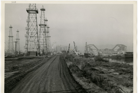
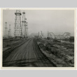
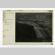
Union Pacific Railroad Company private road (ddr-csujad-43-251)
Photograph number SP-5208 of a private road. Note on the back side reads: Private Road of the Union Pacific R. R. Co. [Railroad Company], immediately adjacent the southerly side of Cerritos Channel looking westerly. In foreground showing portion of background of photograph SP-5207. See this object in the California State Universities Japanese American Digitization project site: …
img
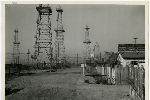
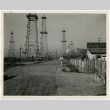
Union Pacific Rail Road Company private road (ddr-csujad-43-252)
Photograph number SP-5210 of a private road. Note on the back side reads: Private Road of the Union Pacific R. R. Co.[Railroad Company], immediately adjacent the southerly side of Cerritos Channel looking westerly. In foreground showing portion of background of photograph SP-5209. See this object in the California State Universities Japanese American Digitization project site: ter_04_053_001
img
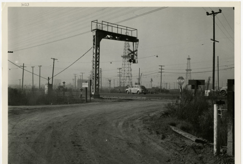
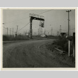
Union Pacific Rail Road Company private road (ddr-csujad-43-253)
Photograph number SP-5213 of a private road. Note on the back side reads: Private Road of the Union Pacific R. R. Co. [Railroad Company], immediately adjacent the southerly side of Cerritos Channel looking Westerly showing connection to Henry Ford Avenue. See this object in the California State Universities Japanese American Digitization project site: ter_04_056_001
img
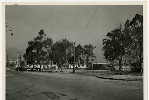
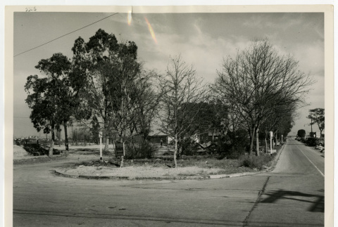
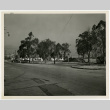
Terminal Way looking west (ddr-csujad-43-254)
Photograph number SP-5325 of Terminal Way. Note on the back side reads: Terminal Way in East San Pedro looking west. See this object in the California State Universities Japanese American Digitization project site: ter_04_057_001
img
Terminal Way looking northeast (ddr-csujad-43-255)
Photograph number SP-5326 of Terminal Way. Note on the back side reads: Terminal Way in East San Pedro looking northeast. See this object in the California State Universities Japanese American Digitization project site: ter_04_059_001
img
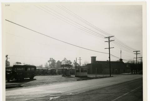
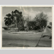
Seaside Avenue looking south southeast (ddr-csujad-43-256)
Photograph number SP-5992 of Seaside Avenue on Terminal Island. Note on the back side of photograph reads: Looking south southeast from the south side of Seaside Avenue. Five hundred feet easterly from Tuna Street, showing existing fire station in right hand background. Terminal Island, Calif. [California]. See this object in the California State Universities Japanese American …
img
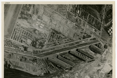
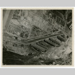
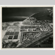
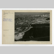
Hammond Lumber Yard (ddr-csujad-43-257)
Aerial photograph number 5727 of Hammond Lumber Yard. Note on the back side reads: General aerial view showing Hammond Lumber Yard in foreground. See this object in the California State Universities Japanese American Digitization project site: ter_04_062_001
img
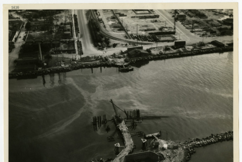
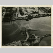
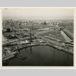
Aerial view of naval drydocks (ddr-csujad-43-258)
Aerial photograph number 5838 of Terminal Island, San Pedro and Long Beach. Note on the back side reads: Naval Drydocks, Terminal Island, San Pedro, California. Long Beach Entrance Channel, Retractable Pontoon Bridge, looking east toward Long Beach. Contract Noy-8012. Aerial. See this object in the California State Universities Japanese American Digitization project site: ter_04_063_001
img
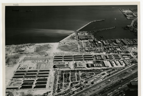
Naval Operating Base (ddr-csujad-43-259)
Aerial photograph number 7445 of Terminal Island. Note on the back side reads: Naval Operating Base, Terminal Island (San Pedro), California. Receiving station, looking south southeast. Contract Noy-8008. Title from note. See this object in the California State Universities Japanese American Digitization project site: ter_04_064_001

img
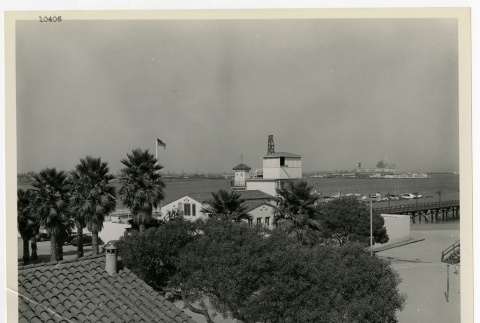
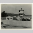
Boathouse at Cabrillo Beach (ddr-csujad-43-260)
Photograph number 10406 of a boathouse at Cabrillo Beach. Note on the back side reads: Boathouse at Cabrillo Beach, San Pedro, California. View showing improvements and alterations made by Navy looking northeast. See this object in the California State Universities Japanese American Digitization project site: ter_04_065_001
img
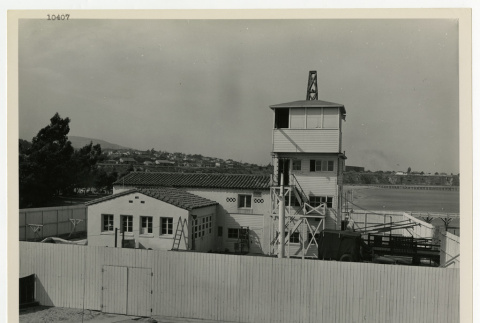
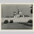
Boathouse at Cabrillo Beach (ddr-csujad-43-261)
Photograph number 10407 of a boathouse at Cabrillo Beach. Note on the back side reads: Boathouse at Cabrillo Beach, San Pedro, California. View showing improvements and alterations made by Navy looking northwesterly. Title from note. See this object in the California State Universities Japanese American Digitization project site: ter_04_066_001
img
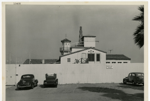
Boathouse at Cabrillo Beach (ddr-csujad-43-262)
Photograph number 10407 of a boathouse at Cabrillo Beach. Note on the back side reads: Boathouse at Cabrillo Beach, San Pedro, California. View showing improvements and alterations mady [made] by Navy looking easterly. Title from note. See this object in the California State Universities Japanese American Digitization project site: ter_04_089_001
img
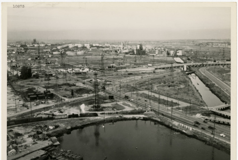
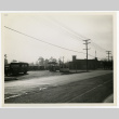
Anaheim Street looking northeast (ddr-csujad-43-263)
Photograph number 10875 of Anaheim Street. Handwritten note on the back side reads: Anaheim Street Viaduct Anaheim Street near Henry Ford Avenue looking n.e. [northeast]. See this object in the California State Universities Japanese American Digitization project site: ter_04_090_001
img
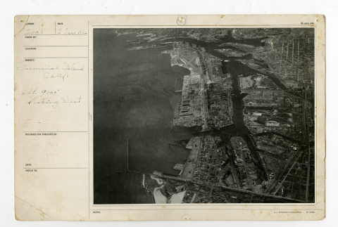
Terminal Island looking west (ddr-csujad-43-264)
Aerial photograph number 2008 of Terminal Island. Caption reads: Terminal Island, Calif. [California] Alt. [Altitude] 9000' looking west. See this object in the California State Universities Japanese American Digitization project site: ter_05_002
img
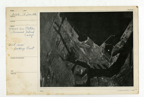
Naval Air Station looking east (ddr-csujad-43-265)
Photograph number 2006 of the Naval Air Station of Terminal Island. Subject reads: Naval Air Station Terminal Island Calif. [California] Alt. [Altitude] 12000' looking east. See this object in the California State Universities Japanese American Digitization project site: ter_05_003
img
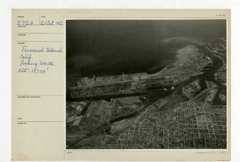
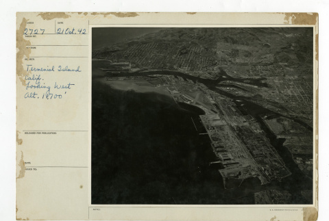
Terminal Island looking south (ddr-csujad-43-266)
Aerial photograph number 2728 of Terminal Island. Subject reads: Terminal Island Calif. [California] looking south alt. [Altitude] of 11,700'. See this object in the California State Universities Japanese American Digitization project site: ter_05_005
img
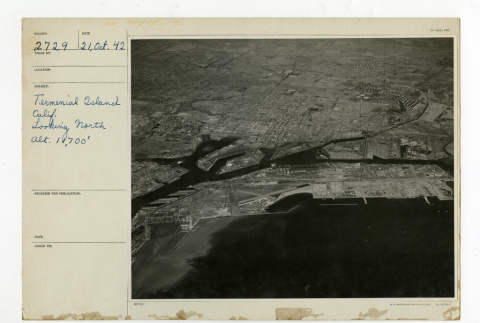
Terminal Island looking north (ddr-csujad-43-267)
Aerial photograph number 2729 of Terminal Island. Subject reads: Termenial [Terminal] Island Calif [California] looking North Alt. [Altitude] 11,700'. See this object in the California State Universities Japanese American Digitization project site: ter_05_006
img
Terminal Island looking east (ddr-csujad-43-268)
Aerial photograph number 2726 of Terminal Island. Subject reads: Termenial [Terminal] Island Calif. [California] looking east alt. [Altitude] 11,700'. See this object in the California State Universities Japanese American Digitization project site: ter_05_007
img
Terminal Island looking west (ddr-csujad-43-269)
Aerial photograph number 2726 of Terminal Island. Subject reads: Termienial [Terminal] Island Califo. [California] looking west Alt. [Altitude] 11,700'. See this object in the California State Universities Japanese American Digitization project site: ter_05_008
img
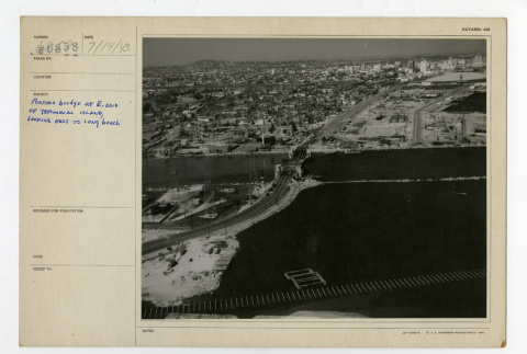
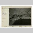
Pontoon bridge near Long Beach (ddr-csujad-43-270)
Aerial photograph number 6858 of the pontoon bridge. Caption reads: Pontoon bridge at E. [east] end of Terminal Island, looking east to Long Beach. See this object in the California State Universities Japanese American Digitization project site: ter_05_009
img
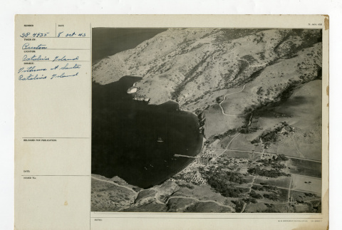
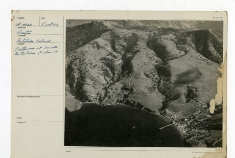
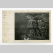
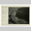
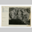
Santa Catalina Isthmus (ddr-csujad-43-271)
Aerial photograph number Sp-4935 of the Isthmus at Santa Catalina Island. See this object in the California State Universities Japanese American Digitization project site: ter_05_010
img
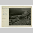
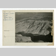
Catalina Island Isthmus (ddr-csujad-43-272)
Aerial photograph number SP-4936 of the Isthmus at Santa Catalina Island. See this object in the California State Universities Japanese American Digitization project site: ter_05_011
img
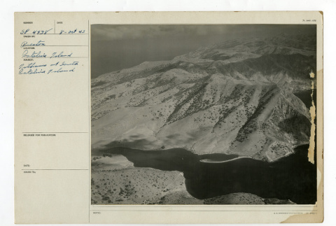
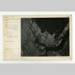
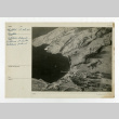
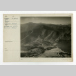
Catalina Island Isthmus (ddr-csujad-43-273)
Aerial photograph number SP-4938 of the Isthmus on Santa Catalina Island. See this object in the California State Universities Japanese American Digitization project site: ter_05_012
img
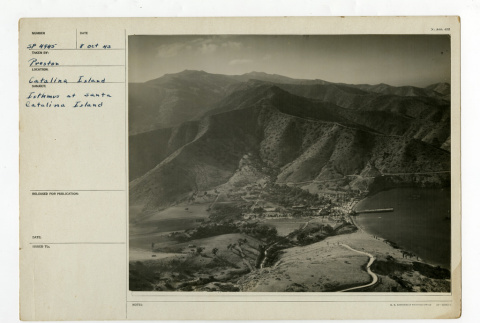
Catalina Island Isthmus (ddr-csujad-43-274)
Aerial photograph number SP-4945 of the Isthmus at Santa Catalina Island. See this object in the California State Universities Japanese American Digitization project site: ter_05_013
img
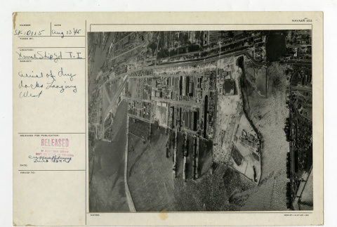
Naval shipyard on Terminal Island (ddr-csujad-43-275)
Aerial photograph number Sp-10115 of the naval shipyard on Terminal Island. Subject reads: Aerial of drydocks looking west. See this object in the California State Universities Japanese American Digitization project site: ter_05_014